
IMAGES TAKEN NEAR TO
Market Street, ROCHDALE, OL12 8JB
Introduction
This page details the photographs taken nearby to Market Street, OL12 8JB by members of the Geograph project.
The Geograph project started in 2005 with the aim of publishing, organising and preserving representative images for every square kilometre of Great Britain, Ireland and the Isle of Man.

There are currently over 7.5m images from over14,400 individuals and you can help contribute to the project by visiting https://www.geograph.org.uk
Image Map
Images are licensed for reuse under creativecommons.org/licenses/by-sa/2.0
Notes
- Clicking on the map will re-center to the selected point.
- The higher the marker number, the further away the image location is from the centre of the postcode.
Image Listing (17 Images Found)
Images are licensed for reuse under creativecommons.org/licenses/by-sa/2.0
Image
Details
Distance
1
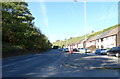
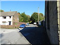
Market Street, Shawforth
Looking north west on the A671.
Image: © JThomas
Taken: 10 Oct 2018
0.01 miles
3
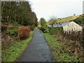
Former railway trackbed
The Rochdale to Bacup branch line was cut into the hillside on the climb beyond Shawforth. Now a cycle route and here used as a rear garden for the terraced row of cottages sandwiched between the railway and the road.
Image: © Kevin Waterhouse
Taken: 27 Jan 2023
0.03 miles
6
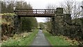
Footbridge over former Rochdale to Bacup Railway
Footbridge North of Shawforth Station connecting Old Lane with Market Street
Image: © Kevin Waterhouse
Taken: 8 Apr 2021
0.07 miles
7
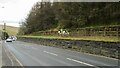
Horse Riders on Former Rochdale-Bacup Railway
View down Market Street with former railway to right but within a cutting now filled. Peel Mill Chimney, Shawforth in the distance.
Image: © Kevin Waterhouse
Taken: 8 Apr 2021
0.09 miles
8
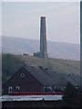
Chimney
The chimney belonged to Peel Mill, which was destroyed in a fire in 1956. The collapsed flue for the chimney can be seen in Google Earth leading SW towards the industrial units on the site.
The houses in the foreground are Peel Terrace, Market Street, Shawforth.
Image: © Malcolm Street
Taken: 20 Nov 2005
0.10 miles
9
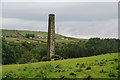
Shawforth chimney
This now stands entirely on its own above the valley.
Image: © Bill Boaden
Taken: 15 Jun 2011
0.12 miles
10
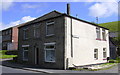
Converted Shop, Market Street, Shawforth
Now a house.
Image: © Robert Wade
Taken: 5 Aug 2007
0.15 miles