
IMAGES TAKEN NEAR TO
Twinegate, ROCHDALE, OL12 6DW
Introduction
This page details the photographs taken nearby to Twinegate, OL12 6DW by members of the Geograph project.
The Geograph project started in 2005 with the aim of publishing, organising and preserving representative images for every square kilometre of Great Britain, Ireland and the Isle of Man.

There are currently over 7.5m images from over14,400 individuals and you can help contribute to the project by visiting https://www.geograph.org.uk
Image Map
Images are licensed for reuse under creativecommons.org/licenses/by-sa/2.0
Notes
- Clicking on the map will re-center to the selected point.
- The higher the marker number, the further away the image location is from the centre of the postcode.
Image Listing (6 Images Found)
Images are licensed for reuse under creativecommons.org/licenses/by-sa/2.0
Image
Details
Distance
1
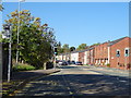
Whitworth Road, Rochdale
Looking north west on the A671.
Image: © JThomas
Taken: 10 Oct 2018
0.08 miles
2
Whitworth Road, Lower Healey
Lined by traditional terraced housing.
Image: © Bill Boaden
Taken: 20 Jul 2012
0.08 miles
3
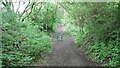
Site of former railway bridge
View along the former track bed of the Rochdale to Bacup branch line where it crossed Lower Healey Lane. The track bed is now a cycleway
Image: © Kevin Waterhouse
Taken: 21 May 2022
0.09 miles
5
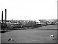
Coal train on the Facit Branch, Rochdale, Lancashire
The steeply graded ex-L.Y.R. Rochdale to Facit branch lost its passenger service as early as 1947, but goods services remained for a while and as late as 1966 there were still occasional coal trains as far as Shawclough. One of the last of these is shown here, for the branch closed completely later that year. The whole area visible here is now greatly changed, being covered with modern housing.
Image: © Dr Neil Clifton
Taken: 25 Aug 1966
0.12 miles
6
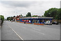
Tesco Express, Whitworth Road
There isn't much competition in the immediate vicinity.
Image: © Bill Boaden
Taken: 20 Jul 2012
0.18 miles