IMAGES TAKEN NEAR TO
Margroy Close, ROCHDALE, OL12 0ES
Introduction
This page details the photographs taken nearby to Margroy Close, OL12 0ES by members of the Geograph project.
The Geograph project started in 2005 with the aim of publishing, organising and preserving representative images for every square kilometre of Great Britain, Ireland and the Isle of Man.

There are currently over 7.5m images from over14,400 individuals and you can help contribute to the project by visiting https://www.geograph.org.uk
Image Map (Loading...)


Getting Data...Please wait
Leaflet Map data © OpenStreetMap
Images are licensed for reuse under creativecommons.org/licenses/by-sa/2.0
Notes
- Clicking on the map will re-center to the selected point.
- The higher the marker number, the further away the image location is from the centre of the postcode.
Image Listing (37 Images Found)
Images are licensed for reuse under creativecommons.org/licenses/by-sa/2.0
Image
Details
Distance
2
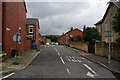
Blanche Street
Residential street with Brown Wardle in the far distance.
Image: © Bill Boaden
Taken: 20 Jul 2012
0.07 miles
3
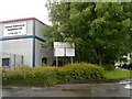
Buckley Road Industrial Estate
Entrance to the Buckley Road Industrial Estate, on Buckley Road, in the Buckley area of Rochdale, Greater Manchester.
Image: © Steven Haslington
Taken: 26 May 2011
0.08 miles
7
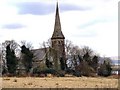
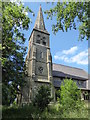
Church of All Saints, Hamer
Foxholes Road
Image: © David Dixon
Taken: 16 Mar 2010
0.10 miles
8
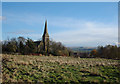
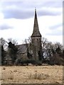
All Saints, Hamer Parish Church, Rochdale
View eastwards from a position on Foxholes Rd.
Image: © michael ely
Taken: 25 Nov 2005
0.12 miles
9
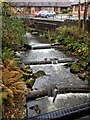
Weirs on brook
View from the bridge at Red Lane, Hamer. The brook below the bridge is Hey Brook but above the bridge may still be Buckley Brook. Behind the camera is a former reservoir and perhaps the weirs were connected with this.
Image: © Kevin Waterhouse
Taken: 24 Oct 2022
0.13 miles
10
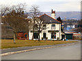
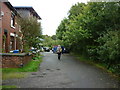
The Donkey
The Donkey at the corner of Syke Road and Binns Nook Road. Viewed from Binns Nook Road.
Image: © David Dixon
Taken: 16 Mar 2010
0.13 miles