Weirs on brook
Introduction
The photograph on this page of Weirs on brook by Kevin Waterhouse as part of the Geograph project.
The Geograph project started in 2005 with the aim of publishing, organising and preserving representative images for every square kilometre of Great Britain, Ireland and the Isle of Man.

There are currently over 7.5m images from over 14,400 individuals and you can help contribute to the project by visiting https://www.geograph.org.uk
Weirs on brook
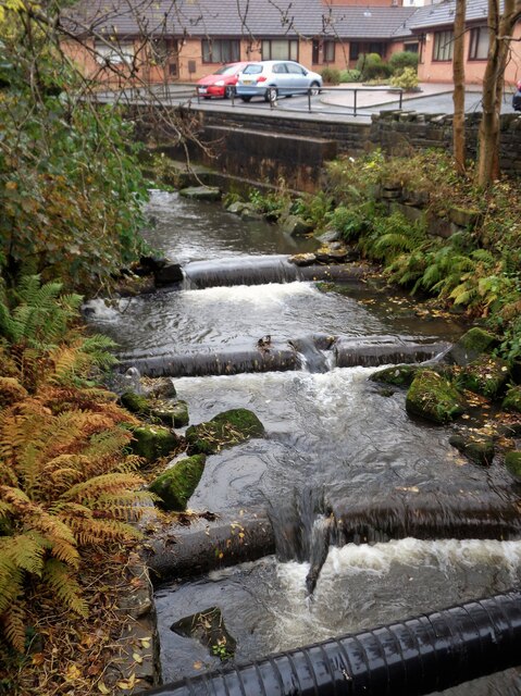
Image: © Kevin Waterhouse Taken: 24 Oct 2022
View from the bridge at Red Lane, Hamer. The brook below the bridge is Hey Brook but above the bridge may still be Buckley Brook. Behind the camera is a former reservoir and perhaps the weirs were connected with this.
Images are licensed for reuse under creativecommons.org/licenses/by-sa/2.0
Image Location
Latitude
53.627934
Longitude
-2.144213