IMAGES TAKEN NEAR TO
Enfield Close, ROCHDALE, OL11 5RT
Introduction
This page details the photographs taken nearby to Enfield Close, OL11 5RT by members of the Geograph project.
The Geograph project started in 2005 with the aim of publishing, organising and preserving representative images for every square kilometre of Great Britain, Ireland and the Isle of Man.

There are currently over 7.5m images from over14,400 individuals and you can help contribute to the project by visiting https://www.geograph.org.uk
Image Map
Images are licensed for reuse under creativecommons.org/licenses/by-sa/2.0
Notes
- Clicking on the map will re-center to the selected point.
- The higher the marker number, the further away the image location is from the centre of the postcode.
Image Listing (14 Images Found)
Images are licensed for reuse under creativecommons.org/licenses/by-sa/2.0
Image
Details
Distance
1
Bagslate Moor
Bagslate Moor summit is on Shelfield Lane between number 97 or 99. Thankfully a window clearer left a ladder beside a lamp post so that I could make sure my head was well above this TuMP summit.
Name: Bagslate Moor
Hill number: 16752
Height: 203m / 666ft
Parent (Ma/M): 2817 Hail Storm Hill
Area: 36: Lancashire, Cheshire & the Southern Pennines
Class: 2
Grid ref: SD864141 (est)
Drop: 36m
Col: 167m
Image: © Rude Health
Taken: 10 Jul 2014
0.11 miles
2
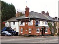
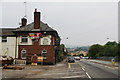
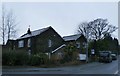
The 'Blue Ball', Cutgate, Rochdale, Lancashire
The sign outside says 'Real Good Food: Real Good Beer'. What more could you want?
Image: © Dr Neil Clifton
Taken: 4 Apr 2004
0.21 miles
4
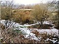
Whittaker Moss
Land between Highwood and Norden Village.
Image: © David Dixon
Taken: 21 Jan 2010
0.22 miles
5
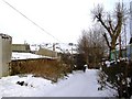
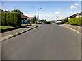
Farm track
Track leading downhill from Whittaker Moss to Norden Village.
Image: © David Dixon
Taken: 12 Jan 2010
0.23 miles
6
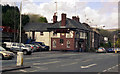
The Blue Ball, Norden
Currently undergoing refurbishment.
Image: © Bill Boaden
Taken: 26 Jul 2012
0.23 miles
9
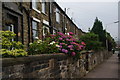
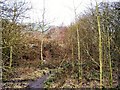
Terraced cottages at the bottom of Old Delph Road
Their proximity to the disused quarry suggests they may have housed quarrymen.
Image: © Bill Boaden
Taken: 26 Jul 2012
0.24 miles