IMAGES TAKEN NEAR TO
Fryent Fields, LONDON, NW9 7HF
Introduction
This page details the photographs taken nearby to Fryent Fields, NW9 7HF by members of the Geograph project.
The Geograph project started in 2005 with the aim of publishing, organising and preserving representative images for every square kilometre of Great Britain, Ireland and the Isle of Man.

There are currently over 7.5m images from over14,400 individuals and you can help contribute to the project by visiting https://www.geograph.org.uk
Image Map
Images are licensed for reuse under creativecommons.org/licenses/by-sa/2.0
Notes
- Clicking on the map will re-center to the selected point.
- The higher the marker number, the further away the image location is from the centre of the postcode.
Image Listing (116 Images Found)
Images are licensed for reuse under creativecommons.org/licenses/by-sa/2.0
Image
Details
Distance
1
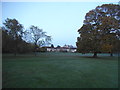
West Hendon Playing Fields
You can see the office blocks on The Hyde
Image: © David Howard
Taken: 15 Nov 2014
0.05 miles
4
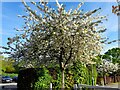
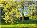
Spring blossom in West Hendon playing fields
Image: © David Howard
Taken: 3 May 2023
0.08 miles
7
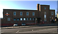
The Hyde Delivery Office, London NW9
Post war sorting office of 1947.
Image: © Jim Osley
Taken: 27 Jan 2012
0.11 miles
9
Sunset over West Hendon Playing Fields
That is not the sun on the horizon, but the floodlights for the match at Kingsbury Town FC. It also explains why there are two of them.
Image: © David Howard
Taken: 15 Nov 2014
0.14 miles