
IMAGES TAKEN NEAR TO
Moorhen Drive, LONDON, NW9 7FF
Introduction
This page details the photographs taken nearby to Moorhen Drive, NW9 7FF by members of the Geograph project.
The Geograph project started in 2005 with the aim of publishing, organising and preserving representative images for every square kilometre of Great Britain, Ireland and the Isle of Man.

There are currently over 7.5m images from over14,400 individuals and you can help contribute to the project by visiting https://www.geograph.org.uk
Image Map
Images are licensed for reuse under creativecommons.org/licenses/by-sa/2.0
Notes
- Clicking on the map will re-center to the selected point.
- The higher the marker number, the further away the image location is from the centre of the postcode.
Image Listing (239 Images Found)
Images are licensed for reuse under creativecommons.org/licenses/by-sa/2.0
Image
Details
Distance
1
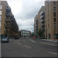
Perryfield Way, West Hendon
This is a rare shot, as the new flats are less than a year old and the old ones are about to be demolished.
Image: © David Howard
Taken: 15 Jun 2019
0.04 miles
3
New flats in West Hendon
These are a great improvement on the old ones but far more people there.
Image: © David Howard
Taken: 19 Oct 2022
0.05 miles
4
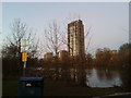
New estate by the Welsh Harp, West Hendon
Image: © David Howard
Taken: 4 Jan 2017
0.06 miles
5
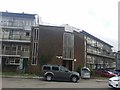
Flats on Tyrrel Way, West Hendon
These are one of the final few to be demolished to be replaced by the far nicer brick buildings which have already taken most of the old ones over.
Image: © David Howard
Taken: 15 Jun 2019
0.06 miles
6
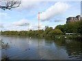
Top end of Brent Reservoir
This is the northern arm of the reservoir where it narrows down a bit and is more obviously a flooded stream valley.
The valley is that of the Silk Stream, part of the Brent catchment.
Image: © Des Blenkinsopp
Taken: 16 Oct 2014
0.06 miles
7
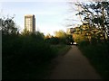
New flats in West Hendon from the park opposite
These are just over half way finished, more are constantly being put up.
Image: © David Howard
Taken: 14 Apr 2020
0.06 miles
8
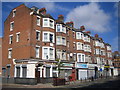
West Hendon Broadway, NW9
The former Roman Road of Watling Street and the current A5 West Hendon Broadway just clip across the south western corner of this grid square, and the 188000 Northing runs straight through the near corner of Trianon House here. The stone plaque set in the bay between the first and second floors reads
St John's Parade
West Hendon
Image: © Nigel Cox
Taken: 22 Jul 2007
0.06 miles
9
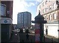
Telford Road, Hendon
This little road (now a footpath) is between West Hendon Broadway and Perryfield Way.
In the background is Franklin House, part of the Tyrrel Way Estate.
Image: © David Anstiss
Taken: 27 Jan 2013
0.07 miles
10
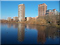
View from Cool Oak Bridge, the northernmost stretch of the Brent Reservoir
Image: © Peter S
Taken: 10 Dec 2022
0.07 miles