IMAGES TAKEN NEAR TO
Rushgrove Avenue, LONDON, NW9 6QP
Introduction
This page details the photographs taken nearby to Rushgrove Avenue, NW9 6QP by members of the Geograph project.
The Geograph project started in 2005 with the aim of publishing, organising and preserving representative images for every square kilometre of Great Britain, Ireland and the Isle of Man.

There are currently over 7.5m images from over14,400 individuals and you can help contribute to the project by visiting https://www.geograph.org.uk
Image Map
Images are licensed for reuse under creativecommons.org/licenses/by-sa/2.0
Notes
- Clicking on the map will re-center to the selected point.
- The higher the marker number, the further away the image location is from the centre of the postcode.
Image Listing (103 Images Found)
Images are licensed for reuse under creativecommons.org/licenses/by-sa/2.0
Image
Details
Distance
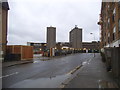
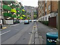
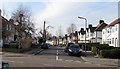
1
Rushgrove Avenue, Colindale
There were two identical white buildings opposite, one was originally a cinema. I expect the other will soon be demolished as well.
Image: © David Howard
Taken: 14 Feb 2018
0.01 miles
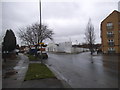
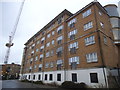
2
Building on Rushgrove Avenue, Colindale
Image: © David Howard
Taken: 14 Feb 2018
0.04 miles
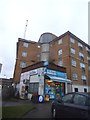
4
New flats on Rushgrove Avenue, Colindale
Image: © David Howard
Taken: 20 Mar 2022
0.05 miles
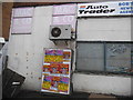
7
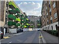
New flats on Rushgrove Avenue, Colindale
The left side was built on the Sainsbury's Homebase site.
Image: © David Howard
Taken: 20 Mar 2022
0.05 miles
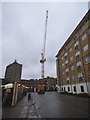
9
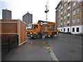
Lorry on Rookery Way, Colindale
Working on the new housing development
Image: © David Howard
Taken: 14 Feb 2018
0.06 miles