IMAGES TAKEN NEAR TO
Aerodrome Road, LONDON, NW9 5RF
Introduction
This page details the photographs taken nearby to Aerodrome Road, NW9 5RF by members of the Geograph project.
The Geograph project started in 2005 with the aim of publishing, organising and preserving representative images for every square kilometre of Great Britain, Ireland and the Isle of Man.

There are currently over 7.5m images from over14,400 individuals and you can help contribute to the project by visiting https://www.geograph.org.uk
Image Map
Images are licensed for reuse under creativecommons.org/licenses/by-sa/2.0
Notes
- Clicking on the map will re-center to the selected point.
- The higher the marker number, the further away the image location is from the centre of the postcode.
Image Listing (95 Images Found)
Images are licensed for reuse under creativecommons.org/licenses/by-sa/2.0
Image
Details
Distance
1
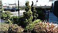
View of a topiary hedge in the Colindale Gardens development from Colindale Avenue
Looking south-southeast.
Image: © Robert Lamb
Taken: 30 Jun 2018
0.02 miles
2
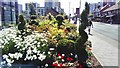
View of flowers and topiary hedges in the Colindale Gardens development from Colindale Lane
Looking south-southwest.
Image: © Robert Lamb
Taken: 30 Jun 2018
0.02 miles
3
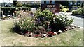
View of flowers in the Colindale Gardens development from Colindale Avenue
Looking south-southeast.
Image: © Robert Lamb
Taken: 30 Jun 2018
0.02 miles
5
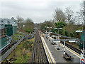
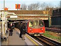
Northern Line, Colindale
Looking along the southbound track from the Colindale Avenue bridge, which straddles Colindale station platforms.
Image: © Robin Webster
Taken: 12 Feb 2011
0.04 miles
6
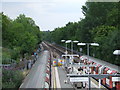
Colindale station
Colindale station is on London Underground's Northern Line. This photo was taken from a road bridge which crosses over the station.
In this photo, a southbound train has just left the station, and the first carriage is past the signal. The signal will have turned to red just after the front of the train had passed it.
Image: © Malc McDonald
Taken: 3 Jul 2011
0.05 miles
7
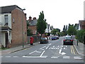
Booth Road, Colindale
Booth Road, a residential road in Colindale, North West London.
Image: © Malc McDonald
Taken: 3 Jul 2011
0.05 miles
8
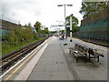
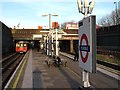
Colindale Underground station
The extension beyond Golders Green to Hendon and Edgware, delayed by the First World War, finally opened to Hendon Central in 1923 and on to Edgware on 18th August 1924. Colindale station also opened on 18th August 1924 on what was then the 'Hampstead and Highgate Line', the first station of the second section of the extension to Edgware. The opening of the station spurred the development of Colindale. In 1933 it became part of the London Passenger Transport Board's Northern line as the Edgware branch.
T. E. Lawrence regularly used the station when he was stationed at the nearby Hendon Aerodrome, and it was the source of his pen name "Colin Dale".
Colindale tube station was severely damaged during The Blitz. At 8:45 pm on 25th September 1940 the station was hit by a large bomb. Two trains were at the station at the time of the explosion, and 13 people were killed.
This view is from the central platform looking south. A train bound for Edgware is approaching.
Image: © Marathon
Taken: 14 Oct 2015
0.05 miles