IMAGES TAKEN NEAR TO
Grahame Park Way, LONDON, NW9 5QY
Introduction
This page details the photographs taken nearby to Grahame Park Way, NW9 5QY by members of the Geograph project.
The Geograph project started in 2005 with the aim of publishing, organising and preserving representative images for every square kilometre of Great Britain, Ireland and the Isle of Man.

There are currently over 7.5m images from over14,400 individuals and you can help contribute to the project by visiting https://www.geograph.org.uk
Image Map (Loading...)


Getting Data...Please wait
Leaflet Map data © OpenStreetMap
Images are licensed for reuse under creativecommons.org/licenses/by-sa/2.0
Notes
- Clicking on the map will re-center to the selected point.
- The higher the marker number, the further away the image location is from the centre of the postcode.
Image Listing (156 Images Found)
Images are licensed for reuse under creativecommons.org/licenses/by-sa/2.0
Image
Details
Distance
2
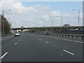
M1 motorway approaching junction 2
This junction, including the long flyover from the A1 was the southern end of the M1 from May 1967 to July 1977.
Image: © Peter Whatley
Taken: 3 Apr 2012
0.05 miles
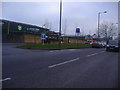
3
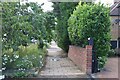
Hendon
Halt Motor Company, Avion Crescent.
Image: © Peter Trimming
Taken: 3 Oct 2021
0.05 miles
4
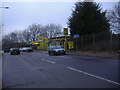
Grahame Park Way northbound
This used to be Hendon aerodrome, and there was no road between Colindale and Mill Hill until Grahame Park estate was built on the site in the 70s.
Image: © David Howard
Taken: 1 Feb 2011
0.05 miles
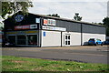
5
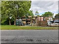
Weatherwell Builders Merchant on Grahame Park Way
Image: © David Howard
Taken: 12 May 2022
0.06 miles
6
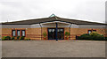
Kingdom Hall of Jehovah's Witnesses - Colindale
Image: © The Carlisle Kid
Taken: 20 Feb 2013
0.09 miles
7
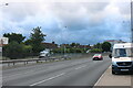
Watford Way, Mill Hill
The Nissan garage was previously Alan Day and originally the K Garage.
Image: © David Howard
Taken: 28 Jul 2021
0.12 miles
8

London Borough of Barnet : Grahame Park
A Kingdom Hall can be seen from here.
Image: © Lewis Clarke
Taken: 4 Oct 2018
0.12 miles
10
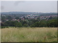
View due north from Sunnyhill Park
The A1/A41 is in the centre, the arch being Pentavia retail park (meaning five ways in Latin, after the junction just before it), with the hills of Stanmore beyond.
Image: © David Howard
Taken: 23 Jul 2013
0.12 miles