
IMAGES TAKEN NEAR TO
Eagle Drive, LONDON, NW9 5BQ
Introduction
This page details the photographs taken nearby to Eagle Drive, NW9 5BQ by members of the Geograph project.
The Geograph project started in 2005 with the aim of publishing, organising and preserving representative images for every square kilometre of Great Britain, Ireland and the Isle of Man.

There are currently over 7.5m images from over14,400 individuals and you can help contribute to the project by visiting https://www.geograph.org.uk
Image Map
Images are licensed for reuse under creativecommons.org/licenses/by-sa/2.0
Notes
- Clicking on the map will re-center to the selected point.
- The higher the marker number, the further away the image location is from the centre of the postcode.
Image Listing (49 Images Found)
Images are licensed for reuse under creativecommons.org/licenses/by-sa/2.0
Image
Details
Distance
1
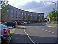
Kenley Avenue, Grahame Park
This is part of a new development replacing some of the original council blocks on Grahame Park in the late 2000s
Image: © David Howard
Taken: 18 Sep 2008
0.11 miles
3
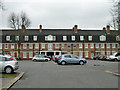
Aeroville
A grade II listed block (or blocks) of flats arranged in a rectilinear C shape around a courtyard. This view looks through the courtyard entrance between the two ends of the C. Designed for the Grahame-White Aviation Company by the company architect, Herbert Matthews, in 1917 and completed 1919. The company were based nearby because of Hendon aerodrome.
Image: © Robin Webster
Taken: 12 Feb 2011
0.15 miles
4
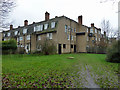
Aeroville, rear view
Not the direction this grade II listed block of flats is intended to be viewed from - for a front view and further information see Image
Image: © Robin Webster
Taken: 12 Feb 2011
0.15 miles
5
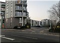
Heybourne Crescent at the junction of Lanacre Avenue
Image: © David Howard
Taken: 2 Mar 2021
0.16 miles
8
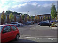
Coningsby Avenue, Grahame Park
This is part of a new development replacing some of the original council blocks on Grahame Park in the late 2000s
Image: © David Howard
Taken: 18 Sep 2008
0.17 miles
10
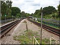
Northern Line north west of Colindale Underground station
Image: © Nigel Thompson
Taken: 14 Sep 2018
0.18 miles