IMAGES TAKEN NEAR TO
NW9 4GD
Introduction
This page details the photographs taken nearby to NW9 4GD by members of the Geograph project.
The Geograph project started in 2005 with the aim of publishing, organising and preserving representative images for every square kilometre of Great Britain, Ireland and the Isle of Man.

There are currently over 7.5m images from over14,400 individuals and you can help contribute to the project by visiting https://www.geograph.org.uk
Image Map
Images are licensed for reuse under creativecommons.org/licenses/by-sa/2.0
Notes
- Clicking on the map will re-center to the selected point.
- The higher the marker number, the further away the image location is from the centre of the postcode.
Image Listing (96 Images Found)
Images are licensed for reuse under creativecommons.org/licenses/by-sa/2.0
Image
Details
Distance
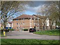
3
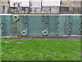
Former industrial site in Aerodrome Road, Colindale
Areodrome Road refers to the famous Hendon Aerodrome which was best-known for its flying displays between the Wars - see https://en.wikipedia.org/wiki/Hendon_Aerodrome
Much of the south side of Aerodrome Road is taken up by the Metropolitan Police Training Establishment (known as the Peel Centre), and there are also some rather run down former industrial sites. This building seems to have once been involved in manufacturing or distributing motor parts.
The north side of Aerodrome Road had a great deal of new building of flats going on at the time this photograph was taken - see http://www.geograph.org.uk/photo/4700616
Image: © Marathon
Taken: 14 Oct 2015
0.08 miles
4
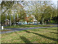
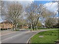
Roundabout at Colindale
Aerodrome Road comes in from the right and Colindale Avenue from the left from Colindale Underground station. The Grahame Park estate is ahead on the site of the old Hendon Aerodrome.
Image: © Marathon
Taken: 28 Oct 2015
0.08 miles
5
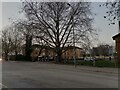
Grahame Park Way from the roundabout
Grahame Park was built on the derelict Hendon Aerodrome in the 70s, and provided a new road linking Colindale and Mill Hill.
Image: © David Howard
Taken: 7 Nov 2013
0.08 miles
6
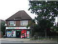
Local shop, Colindale
A local shop in Colindale, North West London.
Image: © Malc McDonald
Taken: 3 Jul 2011
0.08 miles
7
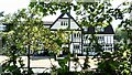
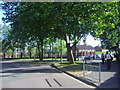
View of the Platt Hall and Writtle House student residences for Middlesex University from Grahame Park Way
Looking south-southeast.
Image: © Robert Lamb
Taken: 30 Jun 2018
0.08 miles
8
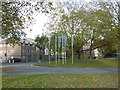
Roundabout at the entrance to the Grahame Park estate
Colindale Avenue is to the left leading to Colindale Underground station. The Grahame Park estate is ahead on the site of the old Hendon Aerodrome.
Image: © Marathon
Taken: 28 Oct 2015
0.08 miles