
IMAGES TAKEN NEAR TO
The Broadway, LONDON, NW7 3TG
Introduction
This page details the photographs taken nearby to The Broadway, NW7 3TG by members of the Geograph project.
The Geograph project started in 2005 with the aim of publishing, organising and preserving representative images for every square kilometre of Great Britain, Ireland and the Isle of Man.

There are currently over 7.5m images from over14,400 individuals and you can help contribute to the project by visiting https://www.geograph.org.uk
Image Map
Images are licensed for reuse under creativecommons.org/licenses/by-sa/2.0
Notes
- Clicking on the map will re-center to the selected point.
- The higher the marker number, the further away the image location is from the centre of the postcode.
Image Listing (102 Images Found)
Images are licensed for reuse under creativecommons.org/licenses/by-sa/2.0
Image
Details
Distance
3
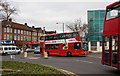
Passing Buses
221's pass at the junction of Flower Lane with The Broadway in Mill Hill. Two different types that are operated on the route by Arriva are visible here. The one taking centre stage is a Wright Gemini bodied Volvo whilst the one coming into view on the right is an Alexander ALX400 bodied DAF. On the left of the photo is a Star Bus operated Renault mini-bus. Star Bus currently operate services on behalf of Barnet Council transporting handicapped children to school.
Image: © Martin Addison
Taken: 10 Mar 2010
0.04 miles
4
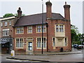
125-127 The Broadway
Former Bank.
Image: © Oast House Archive
Taken: 6 Jun 2017
0.04 miles
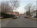
6
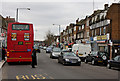
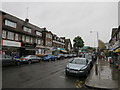
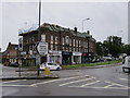
The Broadway, Mill Hill
Originally part of Lawrence Street (named after a large local farm), it was renamed The Broadway some time after 1910 when the shopping area began to develop. Although there had been a station on the London to Bedford railway since 1868, little growth happened in the area until the GNR opened a station at The Hale in 1906 which gave access to the Underground network at Finsbury Park. The opening of the Barnet By-Pass in 1928 triggered the growth into a fully-fledged London suburb. Information from Barnet Online at http://www.barnet.gov.uk/index/leisure-culture/libraries/archives/archives-histories/archives-millhill/archives-millhill-millhillbroadway.htm.
Image: © Martin Addison
Taken: 10 Mar 2010
0.04 miles
7
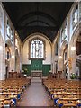
St Michael & All Angels, Flower Lane, Mill Hill - East end
Image: © John Salmon
Taken: 17 Sep 2004
0.04 miles
8
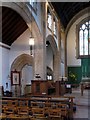
St Michael & All Angels, Flower Lane, Mill Hill - Interior
Image: © John Salmon
Taken: 17 Sep 2004
0.04 miles
9
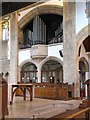
St Michael & All Angels, Flower Lane, Mill Hill - Organ
Image: © John Salmon
Taken: 17 Sep 2004
0.04 miles
10
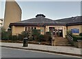
Catholic Church of the Sacred Heart and Mary Immaculate, Mill Hill
I went to a dancing show here for one of my birthdays in the 70s.
Image: © David Howard
Taken: 2 Mar 2021
0.04 miles