IMAGES TAKEN NEAR TO
Middle Dene, LONDON, NW7 3BA
Introduction
This page details the photographs taken nearby to Middle Dene, NW7 3BA by members of the Geograph project.
The Geograph project started in 2005 with the aim of publishing, organising and preserving representative images for every square kilometre of Great Britain, Ireland and the Isle of Man.

There are currently over 7.5m images from over14,400 individuals and you can help contribute to the project by visiting https://www.geograph.org.uk
Image Map (Loading...)


Getting Data...Please wait
Leaflet Map data © OpenStreetMap
Images are licensed for reuse under creativecommons.org/licenses/by-sa/2.0
Notes
- Clicking on the map will re-center to the selected point.
- The higher the marker number, the further away the image location is from the centre of the postcode.
Image Listing (40 Images Found)
Images are licensed for reuse under creativecommons.org/licenses/by-sa/2.0
Image
Details
Distance
2
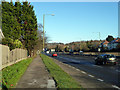
Footpath by the A1
The A1 has a path (also for cycles) along each side for a considerable distance, although safe means of getting from one to the other are rather limited.
Image: © Robin Webster
Taken: 2 Dec 2012
0.08 miles
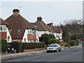
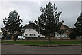
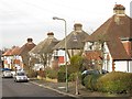
5
Ellesmere Avenue, NW7
Shows the location of Image
Image: © Mike Quinn
Taken: 14 Feb 2012
0.11 miles
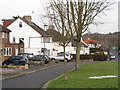
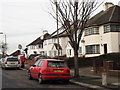
6
Ellesmere Avenue, NW7 (3)
Shows the location of Image
Image: © Mike Quinn
Taken: 14 Feb 2012
0.11 miles
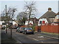
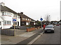
8
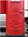
Edward VII postbox, Ellesmere Avenue, NW7 - royal cipher
See Image
Image: © Mike Quinn
Taken: 14 Feb 2012
0.11 miles
9
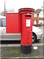
Edward VII postbox, Ellesmere Avenue, NW7
Image: © Mike Quinn
Taken: 14 Feb 2012
0.11 miles