
IMAGES TAKEN NEAR TO
Lyndhurst Avenue, LONDON, NW7 2AD
Introduction
This page details the photographs taken nearby to Lyndhurst Avenue, NW7 2AD by members of the Geograph project.
The Geograph project started in 2005 with the aim of publishing, organising and preserving representative images for every square kilometre of Great Britain, Ireland and the Isle of Man.

There are currently over 7.5m images from over14,400 individuals and you can help contribute to the project by visiting https://www.geograph.org.uk
Image Map
Images are licensed for reuse under creativecommons.org/licenses/by-sa/2.0
Notes
- Clicking on the map will re-center to the selected point.
- The higher the marker number, the further away the image location is from the centre of the postcode.
Image Listing (83 Images Found)
Images are licensed for reuse under creativecommons.org/licenses/by-sa/2.0
Image
Details
Distance
3
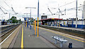
Mill Hill Broadway station, 2007
View NW, towards Bedford, and Leicester and the North on the ex-Midland main line from St Pancras, also (since 1987) Thameslink from Brighton and Sutton via Farringdon, electrification from Bedford into St Pancras and thence by the Metropolitan and Farringdon to Moorgate having been achieved in 1982. Main lines are on the left.
Image: © Ben Brooksbank
Taken: 28 Jul 2007
0.06 miles
4
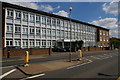
Churchill House, Bunn's Lane
A block of serviced offices: as it backs onto the main railway line and the M1, one hopes the soundproofing is good.
Image: © Christopher Hilton
Taken: 19 Apr 2017
0.08 miles
5

Lyndhurst Park
A small park located behind Lyndhurst Avenue, the houses of which are on the left. The houses to the right of the photo are on Benningholme Road.
Image: © Martin Addison
Taken: 25 Feb 2011
0.10 miles
6
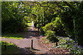
Path along the side of Woodcroft Park
Image: © Christopher Hilton
Taken: 19 Apr 2017
0.10 miles
7
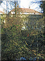
The course of the former Mill Hill East to Edgware railway line west of Bunn's Lane
Image: © Mike Quinn
Taken: 26 Feb 2020
0.11 miles
8
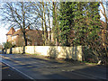
The Bunn's Lane bridge over the former Mill Hill East to Edgware railway line
See Image
Image: © Mike Quinn
Taken: 26 Feb 2020
0.11 miles
9
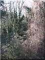
Jungle in Mill Hill
This is actually the course of the former Mill Hill East to Edgware railway line, west of Image See Image
Image: © Mike Quinn
Taken: 26 Feb 2020
0.11 miles
10
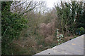
Old GNR Railway Route in Mill Hill
View from the bridge that used to carry Bunns Lane over the extension of the GNR line to Edgware from Mill Hill East, which was closed in 1964. This is close to the site of The Hale station which prompted the initial growth of Mill Hill back in 1906 and I believe was located on the opposite side of the bridge. The track bed here is totally overgrown and recent building work on the opposite side of the bridge renders it unlikely that the route will ever be reopened - There remains a requirement to keep the route open for a possible future extension of the Northern Line from Mill Hill East to Copthall, but not this far.
Image: © Martin Addison
Taken: 10 Mar 2010
0.11 miles