
IMAGES TAKEN NEAR TO
Langley Park, LONDON, NW7 2AA
Introduction
This page details the photographs taken nearby to Langley Park, NW7 2AA by members of the Geograph project.
The Geograph project started in 2005 with the aim of publishing, organising and preserving representative images for every square kilometre of Great Britain, Ireland and the Isle of Man.

There are currently over 7.5m images from over14,400 individuals and you can help contribute to the project by visiting https://www.geograph.org.uk
Image Map
Images are licensed for reuse under creativecommons.org/licenses/by-sa/2.0
Notes
- Clicking on the map will re-center to the selected point.
- The higher the marker number, the further away the image location is from the centre of the postcode.
Image Listing (99 Images Found)
Images are licensed for reuse under creativecommons.org/licenses/by-sa/2.0
Image
Details
Distance
1
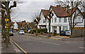
Langley Park
A cul-de-sac in Mill Hill off Bunns Lane.
Image: © Martin Addison
Taken: 10 Mar 2010
0.01 miles
2
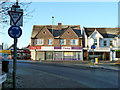
Businesses, Mill Hill
One shop selling milk shakes, two businesses dealing with physical well-being.
Image: © Robin Webster
Taken: 2 Dec 2012
0.03 miles
3
Roundabout at junction of Bunns Lane and Grahame Park Way
The railway crosses the bridge with the M1 motorway on the next bridge behind it.
Image: © David Howard
Taken: 30 Jul 2008
0.04 miles
4
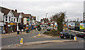
Bunns Lane Meets Hale Lane
Bunns Lane curves round the station car park at Mill Hill Broadway to meet Hale Lane and The Broadway at a junction which combines a triangle with a mini-roundabout. Hale Lane is opposite in this view that was taken from the stairs leading up to the station car park. The name of Bunns Lane comes from one of the two major farms in the area prior to suburbanisation, the other being Lawrence Farm - see Lawrence Street in the same area.
Image: © Martin Addison
Taken: 10 Mar 2010
0.05 miles
5
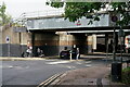
Mill Hill
The A5100, immediately north of the railway station. There are two railway bridges, plus a third which carries the M1 motorway.
Image: © Peter Trimming
Taken: 3 Oct 2021
0.06 miles
6

Mill Hill Broadway station
Mill Hill station was opened by the Midland Railway in 1868 on its extension to St. Pancras. It was renamed Mill Hill Broadway in 1950. The station was rebuilt in the 1960s in connection with the construction of the M1 motorway, which parallels the lines here to the east. This view looks northwards along the two fast lines. The slow lines are to the right.
Image: © Marathon
Taken: 19 Dec 2013
0.06 miles
7

Burnt Oak Brook
The Burnt Oak Brook has its source in Simmonds Mead. Its route through Mill Hill Broadway is contained in a culvert but it surfaces in Lyndhurst Park to pass through Burnt Oak on its way to join the Silk Stream, eventually flowing into The Welsh Harp in West Hendon.
Image: © Martin Addison
Taken: 25 Feb 2011
0.06 miles
8

Please stand clear, fast train approaching
On Mill Hill Broadway station.
Image: © Robin Webster
Taken: 2 Dec 2012
0.06 miles
9

The course of the former Mill Hill East to Edgware railway line west of Bunn's Lane (2)
Now slightly overgrown. See Image
Image: © Mike Quinn
Taken: 26 Feb 2020
0.06 miles
10

St Pancras train approaching Mill Hill Broadway
A Midland Mainline HST, wearing that operator's initial (and somewhat garish) privatisation livery, roars along the Up fast line through Mill Hill Broadway station on the last stage of its journey to London St Pancras.
Image: © Richard Vince
Taken: Unknown
0.06 miles