
IMAGES TAKEN NEAR TO
Inglis Way, LONDON, NW7 1FJ
Introduction
This page details the photographs taken nearby to Inglis Way, NW7 1FJ by members of the Geograph project.
The Geograph project started in 2005 with the aim of publishing, organising and preserving representative images for every square kilometre of Great Britain, Ireland and the Isle of Man.

There are currently over 7.5m images from over14,400 individuals and you can help contribute to the project by visiting https://www.geograph.org.uk
Image Map
Images are licensed for reuse under creativecommons.org/licenses/by-sa/2.0
Notes
- Clicking on the map will re-center to the selected point.
- The higher the marker number, the further away the image location is from the centre of the postcode.
Image Listing (54 Images Found)
Images are licensed for reuse under creativecommons.org/licenses/by-sa/2.0
Image
Details
Distance
1
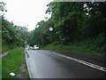
Frith Lane, Mill Hill
A country road in London
Image: © David Howard
Taken: 3 Jun 2008
0.13 miles
2
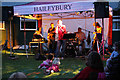
Another Fine Mesh
Local band, Another Fine Mesh, perform at Frith Grange scout camp for guests at a private function. They can normally be seen in pubs around the Barnet - St. Albans area, playing a mix of rock covers from the 1960's to 1990's. Another of the scout huts on the site can be seen behind the temporary marquee.
Image: © Martin Addison
Taken: 13 Jul 2008
0.15 miles
3
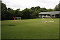
Frith Grange Scout Camp
The tent pitching area with fire pit, left foreground. The site plays host to all age groups within the scouting movement, from beavers upwards. A group of children play football between two temporary goals, erected on site for a private function.
Image: © Martin Addison
Taken: 13 Jul 2008
0.15 miles
4
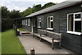
Frith Grange Scout Camp
One of several huts on the site.
Image: © Martin Addison
Taken: 13 Jul 2008
0.15 miles
5
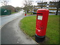
Type K Pillar Box, Bray Road, London NW7
Image: © Stacey Harris
Taken: 16 Dec 2011
0.16 miles
6
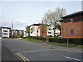
Morphou Road, Millbrook Park
New housing development, Mill Hill.
Image: © JThomas
Taken: 15 Apr 2017
0.18 miles
7
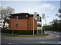
Millbrook Park
New housing development, Mill Hill.
Image: © JThomas
Taken: 15 Apr 2017
0.19 miles
9
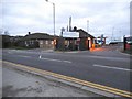
The entrance to Barnet Council depot on Bittacy Hill
Image: © David Howard
Taken: 18 Dec 2013
0.20 miles
10
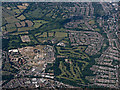
Finchley Golf Club from the air
The former Inglis Barracks site https://en.wikipedia.org/wiki/Inglis_Barracks is to the left of the golf course.
Image: © Thomas Nugent
Taken: 22 Jun 2015
0.21 miles