IMAGES TAKEN NEAR TO
Sanders Lane, LONDON, NW7 1BX
Introduction
This page details the photographs taken nearby to Sanders Lane, NW7 1BX by members of the Geograph project.
The Geograph project started in 2005 with the aim of publishing, organising and preserving representative images for every square kilometre of Great Britain, Ireland and the Isle of Man.

There are currently over 7.5m images from over14,400 individuals and you can help contribute to the project by visiting https://www.geograph.org.uk
Image Map
Images are licensed for reuse under creativecommons.org/licenses/by-sa/2.0
Notes
- Clicking on the map will re-center to the selected point.
- The higher the marker number, the further away the image location is from the centre of the postcode.
Image Listing (118 Images Found)
Images are licensed for reuse under creativecommons.org/licenses/by-sa/2.0
Image
Details
Distance
1
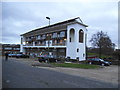
Block of flats on Sanders Lane
Apart from the hollow archways either end this is a very ordinary block, I have no idea what they are for besides appearance as they are completely open and empty. I think the lower floor conceals the bins.
Image: © David Howard
Taken: 18 Dec 2013
0.01 miles
2
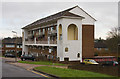
Flats on Sanders Lane
An unusual design of two up, two down flats. I bet those stairwells make some interesting noises when there are strong winds.
Image: © Martin Addison
Taken: 19 Jan 2009
0.01 miles
3
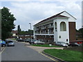
Sanders Lane, Mill Hill
Sanders Lane is a residential road in Mill Hill, in the suburbs of North London.
Image: © Malc McDonald
Taken: 3 Jul 2011
0.01 miles
6
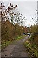
Sanders Lane
Looking from the bridge towards the truncated end of Sanders Lane. Beyond the concrete bollards it is a road serving a housing estate. Barnet's corporate plan proposes reopening Sanders Lane to through traffic by 2011.
Image: © Martin Addison
Taken: 19 Jan 2009
0.03 miles
7
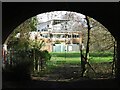
The course of the former Mill Hill East to Edgware railway line east of Sanders Lane (3)
See Image
Image: © Mike Quinn
Taken: 26 Feb 2020
0.03 miles
8
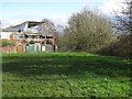
The course of the former Mill Hill East to Edgware railway line east of Sanders Lane (2)
See Image
Image: © Mike Quinn
Taken: 26 Feb 2020
0.03 miles
9
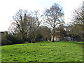
Embankment on the former Mill Hill East to Edgware railway line
See Image
Image: © Mike Quinn
Taken: 26 Feb 2020
0.03 miles