IMAGES TAKEN NEAR TO
Malden Road, LONDON, NW5 4BY
Introduction
This page details the photographs taken nearby to Malden Road, NW5 4BY by members of the Geograph project.
The Geograph project started in 2005 with the aim of publishing, organising and preserving representative images for every square kilometre of Great Britain, Ireland and the Isle of Man.

There are currently over 7.5m images from over14,400 individuals and you can help contribute to the project by visiting https://www.geograph.org.uk
Image Map
Images are licensed for reuse under creativecommons.org/licenses/by-sa/2.0
Notes
- Clicking on the map will re-center to the selected point.
- The higher the marker number, the further away the image location is from the centre of the postcode.
Image Listing (275 Images Found)
Images are licensed for reuse under creativecommons.org/licenses/by-sa/2.0
Image
Details
Distance
1
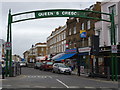
Queen's Crescent NW5
At the junction with Malden Road
Image: © Robin Sones
Taken: 4 Jan 2012
0.02 miles
2
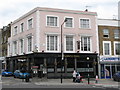
The Sir Robert Peel, Malden Road / Queen's Crescent, NW5
As far as I'm aware, there was only one other pub in London with the same name - see Image
Image: © Mike Quinn
Taken: 7 Aug 2009
0.03 miles
3
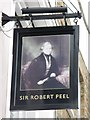
Sign for The Sir Robert Peel, Malden Road / Queen's Crescent, NW5
See Image
Image: © Mike Quinn
Taken: 7 Aug 2009
0.03 miles
4
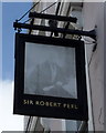
Faded sign for the Sir Robert Peel public house
Image: © JThomas
Taken: 3 Sep 2016
0.04 miles
5
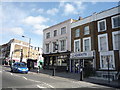
The Sir Robert Peel public house
On Malden Road.
Image: © JThomas
Taken: 3 Sep 2016
0.04 miles
7
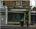
Fishing tackle shop, Malden Road
Dilapidated, but functioning!
Image: © Jim Osley
Taken: 13 May 2011
0.06 miles
8
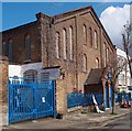
Malden Hall, Kentish Town
Home to the Thanet Youth and Community Centre.
Image: © Jim Osley
Taken: 29 Apr 2016
0.06 miles
9
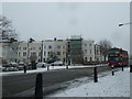
From Charlie Hotel to Shipton Place (118)
Bus in Malden Road
Image: © Basher Eyre
Taken: 20 Jan 2013
0.07 miles