
IMAGES TAKEN NEAR TO
Cressfield Close, LONDON, NW5 4BN
Introduction
This page details the photographs taken nearby to Cressfield Close, NW5 4BN by members of the Geograph project.
The Geograph project started in 2005 with the aim of publishing, organising and preserving representative images for every square kilometre of Great Britain, Ireland and the Isle of Man.

There are currently over 7.5m images from over14,400 individuals and you can help contribute to the project by visiting https://www.geograph.org.uk
Image Map
Images are licensed for reuse under creativecommons.org/licenses/by-sa/2.0
Notes
- Clicking on the map will re-center to the selected point.
- The higher the marker number, the further away the image location is from the centre of the postcode.
Image Listing (147 Images Found)
Images are licensed for reuse under creativecommons.org/licenses/by-sa/2.0
Image
Details
Distance
1
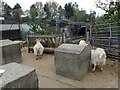
Kentish Town City Farm
Kentish Town City Farm was formed in 1972 becoming the first City Farm to be established in the United Kingdom. It is surrounded by railways with the lines out of St Pancras seen here, as well as London Overground.
Full details can be seen on the farm's website - ktcityfarm.org.uk
Image: © Marathon
Taken: 27 Apr 2023
0.01 miles
2
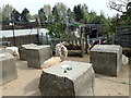
Kentish Town City Farm
Kentish Town City Farm was formed in 1972 becoming the first City Farm to be established in the United Kingdom. It is surrounded by railways with the lines out of St Pancras, as seen here, as well as London Overground.
Full details can be seen on the farm's website - ktcityfarm.org.uk
Image: © Marathon
Taken: 27 Apr 2023
0.01 miles
3
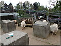
Kentish Town City Farm
Kentish Town City Farm was formed in 1972 becoming the first City Farm to be established in the United Kingdom. It is surrounded by railways with the lines out of St Pancras, where a Thameslink train can be seen here, as well as London Overground.
Full details can be seen on the farm's website - ktcityfarm.org.uk
Image: © Marathon
Taken: 27 Apr 2023
0.01 miles
5
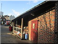
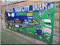
Kentish Town City Farm
The farm occupies a narrow stretch of land overlooking a railway line.
Image: © Peter S
Taken: 6 Feb 2016
0.02 miles

7
Champion the horse at Kentish Town City Farm
Image: © Peter S
Taken: 6 Feb 2016
0.02 miles
8
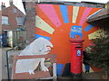
Red pillar box and artwork, Kentish Town City Farm
Image: © Peter S
Taken: 6 Feb 2016
0.03 miles
10
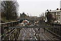
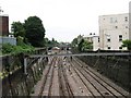
Engineering Works at Carlton Road Junction
Engineers trains stand on the mainline into St Pancras as extensive track renewal is carried out to the west of Kentish Town station. The extent of the work being carried out required the closure of St Pancras as well as the Thameslink route. As a result all services from the north were terminating at West Hampstead over the weekend of 31st January / 1st February 2015.
The tracks diverging in the foreground at Carlton Road Junction lead up to Junction Road Junction and connect there with the line to Barking. The houses on the right are on Dale Road - a very short cul-de-sac.
Image: © Martin Addison
Taken: 31 Jan 2015
0.03 miles