IMAGES TAKEN NEAR TO
Prince Of Wales Road, LONDON, NW5 3LR
Introduction
This page details the photographs taken nearby to Prince Of Wales Road, NW5 3LR by members of the Geograph project.
The Geograph project started in 2005 with the aim of publishing, organising and preserving representative images for every square kilometre of Great Britain, Ireland and the Isle of Man.

There are currently over 7.5m images from over14,400 individuals and you can help contribute to the project by visiting https://www.geograph.org.uk
Image Map
Images are licensed for reuse under creativecommons.org/licenses/by-sa/2.0
Notes
- Clicking on the map will re-center to the selected point.
- The higher the marker number, the further away the image location is from the centre of the postcode.
Image Listing (315 Images Found)
Images are licensed for reuse under creativecommons.org/licenses/by-sa/2.0
Image
Details
Distance
1

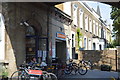
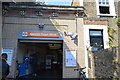
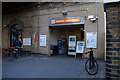
Kentish Town West Station
Now part of London Overground, the station opened on 1 April 1867 as "Kentish Town" and was renamed "Kentish Town West" on 2 June 1924.
Image: © Des Blenkinsopp
Taken: 13 Jul 2017
0.00 miles
2
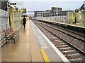
Kentish Town West railway station, Greater London
Opened in 1867 as Kentish Town by the North London Railway on the line from Dalston to Willesden Junction, this station was renamed Kentish Town West in 1924. It closed in 1971, but was rebuilt and reopened in 1981.
View north towards Gospel Oak and Willesden on a wet January morning.
Image: © Nigel Thompson
Taken: 19 Jan 2012
0.03 miles
3

Entrance, Talacre Community Sports Centre
Built in c.2003 to the designs of David Morley Architects. Project details at this http://davidmorleyarchitects.co.uk/projects/talacre.
Image: © Jim Osley
Taken: 17 Apr 2016
0.03 miles
4
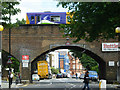
Kentish Town West
A Stratford - Richmond North London Line train pulls into Kentish Town West station (to the left of the picture), over Prince of Wales Road.
Image: © Stephen McKay
Taken: 3 Jul 2007
0.04 miles
5

Talacre Gardens, Kentish Town
This open space with sports facilities was, until 1975, an area of terraced housing. It is named after Talacre Road which runs along the western side, which in turn was named after the Flintshire town.
Image: © Stephen McKay
Taken: 3 Jul 2007
0.05 miles
6

Former Sunday school, Wilkin Street, London NW5
Sunday school building attached to the former Methodist church in nearby Grafton Way.
Image: © Jim Osley
Taken: 17 Apr 2016
0.05 miles
7

Richard of Chichester Catholic School
Grade II listed. http://www.britishlistedbuildings.co.uk/en-477809-richard-of-chichester-catholic-secondary
Image: © N Chadwick
Taken: 25 Aug 2016
0.06 miles