
IMAGES TAKEN NEAR TO
York Rise, LONDON, NW5 1DX
Introduction
This page details the photographs taken nearby to York Rise, NW5 1DX by members of the Geograph project.
The Geograph project started in 2005 with the aim of publishing, organising and preserving representative images for every square kilometre of Great Britain, Ireland and the Isle of Man.

There are currently over 7.5m images from over14,400 individuals and you can help contribute to the project by visiting https://www.geograph.org.uk
Image Map
Images are licensed for reuse under creativecommons.org/licenses/by-sa/2.0
Notes
- Clicking on the map will re-center to the selected point.
- The higher the marker number, the further away the image location is from the centre of the postcode.
Image Listing (241 Images Found)
Images are licensed for reuse under creativecommons.org/licenses/by-sa/2.0
Image
Details
Distance

2
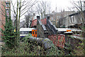
Footbridge To Dartmouth Park
This footbridge between Ingestre Road and Churchill Road crosses two railway lines. The low span crosses the freight only line between Junction Road Junction and Carlton Road Junction which connects the Gospel Oak to Barking Line with the Midland mainline. The high span crosses the Gospel Oak to Barking Line, on which a passing Barking bound service can be seen. The bridge itself is subject to a weight restriction - its spans are probably original and therefore date to circa 1888. Beside the bridge is a large water main, though whether it remains in use is unknown.
Image: © Martin Addison
Taken: 7 Mar 2013
0.02 miles
3
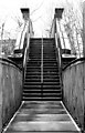
Footbridge To Dartmouth Park
This footbridge between Ingestre Road and Churchill Road crosses two railway lines. The low span in the foreground crosses the freight only line between Junction Road Junction and Carlton Road Junction which connects the Gospel Oak to Barking Line with the Midland mainline. The high span beyond the srairs crosses the Gospel Oak to Barking Line. The bridge is weight restricted and its spans probably date to 1888.
Image: © Martin Addison
Taken: 7 Mar 2013
0.03 miles
4
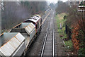
Passing Dartmouth Park
The 7V32 empties from Ferme Park to Acton Yard heads towards Gospel Oak station on the Gospel Oak to Barking Line with DB Schenker class 66, 66043, in charge.
Image: © Martin Addison
Taken: 7 Mar 2013
0.03 miles

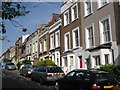
7

View of one of the stairwell towers in Acland Burghley School
Looking northwest.
Image: © Robert Lamb
Taken: 21 Sep 2019
0.05 miles
8

Looking up at the roof in the quad area of Acland Burghley School
Image: © Robert Lamb
Taken: 21 Sep 2019
0.05 miles
9
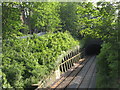
Railway cutting west of Acland Burghley School
Image: © Mike Quinn
Taken: 12 May 2009
0.06 miles
10
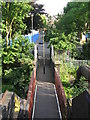
Footbridge over the railway lines west of Acland Burghley School
Image: © Mike Quinn
Taken: 12 May 2009
0.06 miles