1
College Lane, NW5 (9)
Where it passes under the railway lines.
Image: © Mike Quinn
Taken: 7 Aug 2009
0.02 miles
2
Pace garage on Highgate Road
The petrol, like the nearby one on Haverstock Hill was 1.47 a litre, 18p above the local average. They clearly make plenty from the car servicing but why would anyone buy petrol there when they can get it for far less down the road in Chalk Farm?
Image: © David Howard
Taken: 7 Mar 2014
0.03 miles
3
View of Highgate Road Chapel from Chetwynd Road #2
Looking southeast.
Image: © Robert Lamb
Taken: 21 Sep 2019
0.03 miles
4
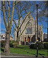
Highgate Road Baptist Chapel
Built in 1877 to the designs of architects F.C. Satchell and R.C. Edwards. (Ref: The Building of England. London 4: North (1998), p. 351). Partly converted into residential accommodation.
Image: © Jim Osley
Taken: 25 Mar 2016
0.03 miles
5
View of Highgate Road Chapel from Chetwynd Road
Looking southeast.
Image: © Robert Lamb
Taken: 21 Sep 2019
0.03 miles
6
College Lane, NW5 (7)
Image: © Mike Quinn
Taken: 7 Aug 2009
0.03 miles
7
Highgate Road
Highgate Road passing under the Gospel Park to Upper Holloway line
Image: © Shaun Ferguson
Taken: 20 Apr 2009
0.03 miles
8
Railway lines west of Acland Burghley School
Image: © Mike Quinn
Taken: 12 May 2009
0.04 miles
9
Sign for The Southampton Arms, Highgate Road, NW5
Image: © Mike Quinn
Taken: 7 Aug 2009
0.04 miles
10
The Southampton Arms, Highgate Road, NW5
According to Gillian Tindall in "The Fields Beneath", the land in this area was seized on the establishment of the Commonwealth in the middle of the 17th C. At the Restoration, the manor reverted to the Crown, and then came into the possession of Isabella, Countess of Arlington, who became the wife of Henry Fitzroy, and left it to her son, Charles Fitzroy, one of Charles II's many progeny. It was still in the Fitzroy family in the late 18th C when the current Charles Fitzroy became Lord Southampton. He had only a leasehold interest in the property but, through the offices of his uncle, the Duke of Grafton, then Prime Minister, he managed to have an Act put through Parliament converting his leasehold to a freehold to himself and his heirs for ever. The Southampton estate received £millions (at 19th C values) from the subsequent vast amount of speculative building on the land. Hence the name of this rather unprepossessing little pub.
Image: © Mike Quinn
Taken: 7 Aug 2009
0.04 miles


