IMAGES TAKEN NEAR TO
St. Davids Place, LONDON, NW4 3PJ
Introduction
This page details the photographs taken nearby to St. Davids Place, NW4 3PJ by members of the Geograph project.
The Geograph project started in 2005 with the aim of publishing, organising and preserving representative images for every square kilometre of Great Britain, Ireland and the Isle of Man.

There are currently over 7.5m images from over14,400 individuals and you can help contribute to the project by visiting https://www.geograph.org.uk
Image Map
Images are licensed for reuse under creativecommons.org/licenses/by-sa/2.0
Notes
- Clicking on the map will re-center to the selected point.
- The higher the marker number, the further away the image location is from the centre of the postcode.
Image Listing (38 Images Found)
Images are licensed for reuse under creativecommons.org/licenses/by-sa/2.0
Image
Details
Distance
1
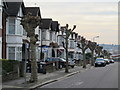
Row of lightly pruned trees in Audley Road, NW4
Image: © Mike Quinn
Taken: 17 Jan 2012
0.11 miles
4

Dartmouth Road / Park Road, NW4 (2)
Shows the location of Image
Image: © Mike Quinn
Taken: 17 Jan 2012
0.14 miles
5

Edward VII postbox, Dartmouth Road / Park Road, NW4 - royal cipher
See Image
Image: © Mike Quinn
Taken: 17 Jan 2012
0.16 miles
6

Edward VII postbox, Dartmouth Road / Park Road, NW4
Image: © Mike Quinn
Taken: 17 Jan 2012
0.16 miles
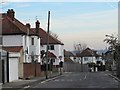
7

Bertram Road, NW4 (2)
West side, south of Vicarage Road.
Image: © Mike Quinn
Taken: 17 Jan 2012
0.16 miles
8

Philex House, West Hendon
Exterior displays some interesting motifs, vaguely Art Deco
Image: © Jim Osley
Taken: 27 Jan 2012
0.17 miles
9

Dartmouth Road / Park Road, NW4
Shows the location of Image
Image: © Mike Quinn
Taken: 17 Jan 2012
0.17 miles
