IMAGES TAKEN NEAR TO
Eton Road, LONDON, NW3 4SS
Introduction
This page details the photographs taken nearby to Eton Road, NW3 4SS by members of the Geograph project.
The Geograph project started in 2005 with the aim of publishing, organising and preserving representative images for every square kilometre of Great Britain, Ireland and the Isle of Man.

There are currently over 7.5m images from over14,400 individuals and you can help contribute to the project by visiting https://www.geograph.org.uk
Image Map
Images are licensed for reuse under creativecommons.org/licenses/by-sa/2.0
Notes
- Clicking on the map will re-center to the selected point.
- The higher the marker number, the further away the image location is from the centre of the postcode.
Image Listing (331 Images Found)
Images are licensed for reuse under creativecommons.org/licenses/by-sa/2.0
Image
Details
Distance
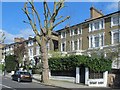
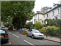
1
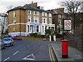
Eton Road, Chalk Farm
Seen from the junction with Adelaide Road. This area was developed in the mid-19th century on land owned by Eton College.
Image: © Stephen McKay
Taken: 27 Feb 2008
0.02 miles
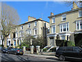
2
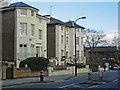
Adelaide Road, Chalk Farm
Looking towards Chalk Farm Underground station. The road on the left, where the car is emerging, is Eton Road.
Image: © Stephen McKay
Taken: 27 Feb 2008
0.03 miles
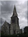
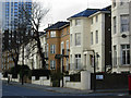
4
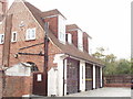
Fire Station, Lancaster Grove and Eton Avenue, Swiss Cottage
"In 1915 Belsize station, in Lancaster Grove, was opened to replace the very cramped St. John's Wood station." Quote from 'Hampstead: Public Services', A History of the County of Middlesex: Volume 9: Hampstead, Paddington (1989), on http://www.british-history.ac.uk/ .
Image: © David Hawgood
Taken: 15 Aug 2005
0.03 miles
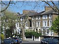
5
Eton Villas, NW3
Looking towards Steeles Road
Image: © Danny P Robinson
Taken: 28 Oct 2006
0.03 miles
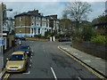
6
Adelaide Road, Chalk Farm
Adelaide Road, seen here at the junction with Eton Road, connects Camden Town with South Hampstead. The housing is a mixture of substantial Victorian villas, '30s mansion blocks and post-war tower blocks.
Image: © Stephen McKay
Taken: 27 Feb 2008
0.03 miles