IMAGES TAKEN NEAR TO
Lower Merton Rise, LONDON, NW3 3SP
Introduction
This page details the photographs taken nearby to Lower Merton Rise, NW3 3SP by members of the Geograph project.
The Geograph project started in 2005 with the aim of publishing, organising and preserving representative images for every square kilometre of Great Britain, Ireland and the Isle of Man.

There are currently over 7.5m images from over14,400 individuals and you can help contribute to the project by visiting https://www.geograph.org.uk
Image Map
Images are licensed for reuse under creativecommons.org/licenses/by-sa/2.0
Notes
- Clicking on the map will re-center to the selected point.
- The higher the marker number, the further away the image location is from the centre of the postcode.
Image Listing (176 Images Found)
Images are licensed for reuse under creativecommons.org/licenses/by-sa/2.0
Image
Details
Distance
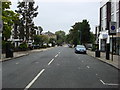
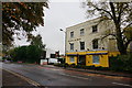
4
Adelaide Road
The road going right is Lower Merton Rise.
Image: © Oxyman
Taken: 21 Aug 2007
0.07 miles
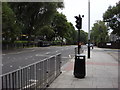
5
The Adelaide, on Adelaide Road
Pub, with yellow front.
Image: © Peter Barr
Taken: 6 Nov 2013
0.07 miles
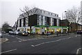
6
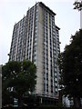
Bray Tower
Dorney Estate, Camden. This towerblock is being re-clad. Taken from Adelaide Road.
Image: © Oxyman
Taken: 21 Aug 2007
0.08 miles
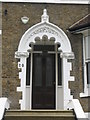
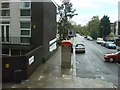
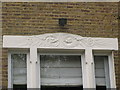
9
Lintel detail, 26-32 Elsworthy Road, NW3 (2)
See Image
Image: © Mike Quinn
Taken: 27 Apr 2010
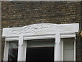
0.08 miles
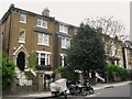
10
Lintel detail, 26-32 Elsworthy Road, NW3
See Image
Image: © Mike Quinn
Taken: 27 Apr 2010
0.08 miles