IMAGES TAKEN NEAR TO
Eton College Road, LONDON, NW3 2DR
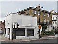
Introduction
This page details the photographs taken nearby to Eton College Road, NW3 2DR by members of the Geograph project.
The Geograph project started in 2005 with the aim of publishing, organising and preserving representative images for every square kilometre of Great Britain, Ireland and the Isle of Man.

There are currently over 7.5m images from over14,400 individuals and you can help contribute to the project by visiting https://www.geograph.org.uk
Image Map
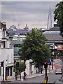
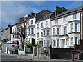
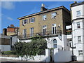
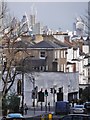
Images are licensed for reuse under creativecommons.org/licenses/by-sa/2.0
Notes
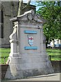
- Clicking on the map will re-center to the selected point.
- The higher the marker number, the further away the image location is from the centre of the postcode.
Image Listing (439 Images Found)
Images are licensed for reuse under creativecommons.org/licenses/by-sa/2.0
Image
Details
Distance
1
Haverstock Hill
At the junction of Prince of Wales Road
Image: © Robin Sones
Taken: 23 Jun 2013
0.03 miles
2
Haverstock Hill, NW3
The northeast side, south of Prince of Wales Road.
Image: © Mike Quinn
Taken: 5 Apr 2017
0.03 miles
3
Haverstock Hill, NW3 (2)
The northeast side, south of Prince of Wales Road.
Image: © Mike Quinn
Taken: 5 Apr 2017
0.03 miles
4
View from Haverstock Hill NW3
At the junction with Prince of Wales Road
Image: © Robin Sones
Taken: 26 Apr 2013
0.04 miles
5
Haverstock Hill / Prince of Wales Road, NW3
Shows the location of Image
Image: © Mike Quinn
Taken: 24 Apr 2013
0.04 miles
6
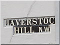
Sign for Haverstoc Hill, NW
The "k" has been obscured by boarding over the adjacent window - see Image Somewhat spookily, the sign and the building it's on can also be seen in the image immediately previously submitted for TQ2784 - Image (photographed by R Sones).
Image: © Mike Quinn
Taken: 24 Apr 2013
0.04 miles
7
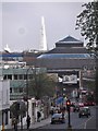
Haverstock Hill NW3
Zoomed in to the Chalk Farm junction
Image: © Robin Sones
Taken: 26 Apr 2013
0.05 miles
8
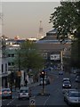
Haverstock Hill NW3
Looking to the junction of Prince of Wales Road
Image: © Robin Sones
Taken: 9 Apr 2011
0.05 miles
9

The London County Council lives on!
The upper blue strip reads "LONDON COUNTY COUNCIL" and the lower "MAITLAND PARK ESTATE". The LCC was formed in 1889; it was replaced by the Greater London Council (GLC) which was established in 1963 (and abolished in 1986) - see http://www.london.gov.uk/london-life/city-government/history.jsp.
Image: © Mike Quinn
Taken: 1 Oct 2008
0.05 miles
10
Plaque at the entrance of the former LCC's Maitland Park Estate
The location of this plaque is shown in Image
Image: © Mike Quinn
Taken: 5 Apr 2017
0.05 miles