IMAGES TAKEN NEAR TO
Blackstone Road, LONDON, NW2 6DA
Introduction
This page details the photographs taken nearby to Blackstone Road, NW2 6DA by members of the Geograph project.
The Geograph project started in 2005 with the aim of publishing, organising and preserving representative images for every square kilometre of Great Britain, Ireland and the Isle of Man.

There are currently over 7.5m images from over14,400 individuals and you can help contribute to the project by visiting https://www.geograph.org.uk
Image Map
Images are licensed for reuse under creativecommons.org/licenses/by-sa/2.0
Notes
- Clicking on the map will re-center to the selected point.
- The higher the marker number, the further away the image location is from the centre of the postcode.
Image Listing (145 Images Found)
Images are licensed for reuse under creativecommons.org/licenses/by-sa/2.0
Image
Details
Distance
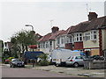
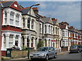
1
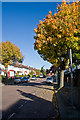
Blackstone Road
Semi-detached housing and some gloious autumn colour from the Maple trees.
Image: © Martin Addison
Taken: 23 Oct 2009
0.01 miles
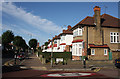
2
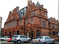
The Crown
Legendary pub now extended into a large hotel, although the Crown remains a great Cricklewood institution.
Image: © Noel Jenkins
Taken: Unknown
0.02 miles
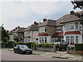
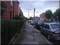
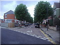
5
Anson Road
Semi-detached housing seen from the junction with Blackstone Road.
Image: © Martin Addison
Taken: 23 Oct 2009
0.05 miles
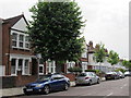
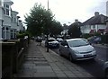
10
Cedar Road from Olive Road, Cricklewood
Image: © David Howard
Taken: 3 Oct 2013
0.08 miles