IMAGES TAKEN NEAR TO
Park Avenue, NW2 5AR
Introduction
This page details the photographs taken nearby to Park Avenue, NW2 5AR by members of the Geograph project.
The Geograph project started in 2005 with the aim of publishing, organising and preserving representative images for every square kilometre of Great Britain, Ireland and the Isle of Man.

There are currently over 7.5m images from over14,400 individuals and you can help contribute to the project by visiting https://www.geograph.org.uk
Image Map
Images are licensed for reuse under creativecommons.org/licenses/by-sa/2.0
Notes
- Clicking on the map will re-center to the selected point.
- The higher the marker number, the further away the image location is from the centre of the postcode.
Image Listing (182 Images Found)
Images are licensed for reuse under creativecommons.org/licenses/by-sa/2.0
Image
Details
Distance
1
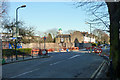
Junction of St Pauls Avenue and Park Avenue, NW10
Image: © Robin Webster
Taken: 19 Mar 2011
0.02 miles
2
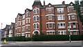
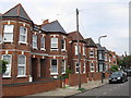
Avenue Mansions
The date 1896 is inscribed at the top of the central tower feature.
Image: © David Martin
Taken: 16 Oct 2015
0.02 miles
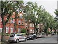
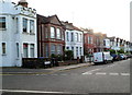
3
St. Paul's Avenue / Grove Road, NW2
Shows the location of Image
Image: © Mike Quinn
Taken: 2 Aug 2011
0.06 miles
6
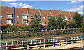
Rear of dwellings in Griffin Close, Dudden Hill, Willesden, west London
At August 2018 we don't seem to have any photos of the Griffin Close frontages but an aerial photo shows a series of courtyards around greens; some small groups of houses have rear gardens. The height and slope of the properties pictured may be designed to form a sound barrier that shelters the front of the estate from the noise of trains. The view is from a Chiltern Railways service bound for Marylebone.
Image: © Robin Stott
Taken: 25 Aug 2017
0.09 miles
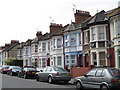
8
Riffel Road, London NW2
A view from the corner of Cranhurst Road looking NW towards the Jeymer Avenue junction.
The Castle http://www.geograph.org.uk/photo/2973199 is on the left.
Image: © Jaggery
Taken: 12 May 2012
0.09 miles
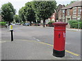
9
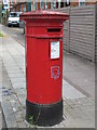
"Anonymous" (Victorian) postbox, St. Paul's Avenue / Grove Road, NW2
The low posting aperture dates this postbox to 1883-87. The location of this postbox is shown in Image, Image and Image
Image: © Mike Quinn
Taken: 2 Aug 2011
0.09 miles
10
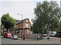
St. Paul's Avenue / Grove Road, NW2 (2)
Shows the location of Image
Image: © Mike Quinn
Taken: 2 Aug 2011
0.10 miles