IMAGES TAKEN NEAR TO
Shoot Up Hill, LONDON, NW2 3XJ

Introduction

This page details the photographs taken nearby to Shoot Up Hill, NW2 3XJ by members of the Geograph project.

The Geograph project started in 2005 with the aim of publishing, organising and preserving representative images for every square kilometre of Great Britain, Ireland and the Isle of Man.

There are currently over 7.5m images from over14,400 individuals and you can help contribute to the project by visiting https://www.geograph.org.uk

Image Map


Images are licensed for reuse under creativecommons.org/licenses/by-sa/2.0
Notes
  • Clicking on the map will re-center to the selected point.
  • The higher the marker number, the further away the image location is from the centre of the postcode.

Image Listing (120 Images Found)

Images are licensed for reuse under creativecommons.org/licenses/by-sa/2.0
  • ...
Image
Details
Distance
1
Shoot-up Hill
Built by the Romans and named Watling Street, the A5 displays its straightness here as it passes through Cricklewood. This is the usual mid morning traffic jam on the A5, caused by the traffic lights at Mill Lane. There will be further delays for drivers as they continue their journey through Kilburn. The driver of the 189 has stopped to allow the blue Rover to pull into the bus lane. I don't think he's doing them a favour as they will probably be caught on the bus camera or one of the street cameras and issued with a £120.00p fine! The bus is TA85, an Alexander ALX400 bodied Dennis Trident.
Image: © Martin Addison Taken: 23 Oct 2009
0.02 miles
2
Shoot-Up Hill (A5)
Looking north west.
Image: © JThomas Taken: 18 Mar 2017
0.02 miles
3
Houses on Shoot-Up Hill (A5)
Image: © JThomas Taken: 18 Mar 2017
0.04 miles
4
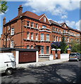
Minster Road, London NW2
Houses on the north side of the road, between Shoot-up Hill and Fordwych Road.
Image: © Jaggery Taken: 12 May 2012
0.05 miles
5
The Mulberry House School, London NW2
On Shoot-Up Hill (A5).
Image: © JThomas Taken: 18 Mar 2017
0.06 miles
6
Minster Road, NW2
Image: © Mike Quinn Taken: 2 Aug 2011
0.06 miles
7
Fordwych Road, NW2 (2)
Between Minster Road and Manstone Road.
Image: © Mike Quinn Taken: 2 Aug 2011
0.06 miles
8
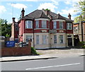
Montrose Hotel, London NW2
The hotel is at 67-69 Shoot-up Hill (the A5). Many online sources state that this is the Mountrose Hotel, but a slightly larger number state that it's the Montrose Hotel. The nameboard on the building is no help at all!
Image: © Jaggery Taken: 12 May 2012
0.07 miles
9
Shoot-up Hill, Cricklewood
Image: © David Howard Taken: 26 Jan 2017
0.07 miles
10
Edgware Road, Cricklewood
Image: © David Howard Taken: 25 Jan 2021
0.07 miles
  • ...