IMAGES TAKEN NEAR TO
Menelik Road, LONDON, NW2 3RR
Introduction
This page details the photographs taken nearby to Menelik Road, NW2 3RR by members of the Geograph project.
The Geograph project started in 2005 with the aim of publishing, organising and preserving representative images for every square kilometre of Great Britain, Ireland and the Isle of Man.

There are currently over 7.5m images from over14,400 individuals and you can help contribute to the project by visiting https://www.geograph.org.uk
Image Map
Images are licensed for reuse under creativecommons.org/licenses/by-sa/2.0
Notes
- Clicking on the map will re-center to the selected point.
- The higher the marker number, the further away the image location is from the centre of the postcode.
Image Listing (66 Images Found)
Images are licensed for reuse under creativecommons.org/licenses/by-sa/2.0
Image
Details
Distance
2
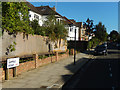
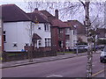
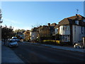
Somali Road, West Hampstead
Somali Road, which leads south-east of Menelik Road, is in one of the farthest-flung parts of the Borough of Camden. The ambience out here is quite different to Camden Town itself, let alone Holborn which is also part of the same borough.
Image: © Stephen McKay
Taken: 13 Sep 2019
0.04 miles
3
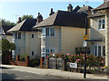
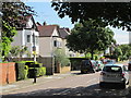
Menelik Road, West Hampstead
Large houses, some detached and some semi-detached, line this suburban street.
Image: © Stephen McKay
Taken: 13 Sep 2019
0.04 miles
6
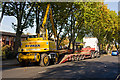
Gigarailer in Westbere Road
A road-rail convertible crane prepares to load itself and an associated flatwagon onto a waiting lowloader pending a move to the next work site.
Image: © Martin Addison
Taken: 23 Oct 2009
0.06 miles
8
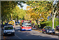
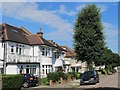
C11 on Westbere Road
DLF95 carefully negotiates a speed hump in bright autumn sunshine. The C11 routes between Brent Cross and Archway Station via Finchley Road.
Image: © Martin Addison
Taken: 23 Oct 2009
0.08 miles
9
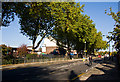
Westbere Road
A cyclist takes advantage of the sweep downhill after passing Hampstead School to pick up some speed before the climb up to Mill Lane. Behind the fence on the left is Westcroft Close, a modern housing estate. The London Plane trees lining the boundary look impressive in the bright autumn sunshine. And no, that's not the photographers shadow in the foreground!
Image: © Martin Addison
Taken: 23 Oct 2009
0.09 miles