IMAGES TAKEN NEAR TO
St. Pauls Crescent, LONDON, NW1 9XS
Introduction
This page details the photographs taken nearby to St. Pauls Crescent, NW1 9XS by members of the Geograph project.
The Geograph project started in 2005 with the aim of publishing, organising and preserving representative images for every square kilometre of Great Britain, Ireland and the Isle of Man.

There are currently over 7.5m images from over14,400 individuals and you can help contribute to the project by visiting https://www.geograph.org.uk
Image Map
Images are licensed for reuse under creativecommons.org/licenses/by-sa/2.0
Notes
- Clicking on the map will re-center to the selected point.
- The higher the marker number, the further away the image location is from the centre of the postcode.
Image Listing (59 Images Found)
Images are licensed for reuse under creativecommons.org/licenses/by-sa/2.0
Image
Details
Distance
2
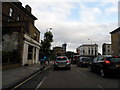
St. Augustine's Road, near Camden Town
St. Augustine's Road is a residential road in the inner suburbs of north London.
Image: © Malc McDonald
Taken: 26 Jan 2019
0.07 miles
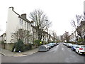
3

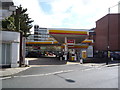
York Way, near Holloway
York Way in inner north London.
Image: © Malc McDonald
Taken: 26 Jan 2019
0.07 miles
5
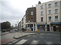
Camden Park Road at the junction of York Road
Image: © David Howard
Taken: 28 Aug 2014
0.10 miles
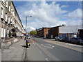
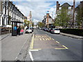
7
York Way at the junction of Brewery Road
Image: © David Howard
Taken: 29 Aug 2012
0.11 miles
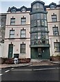
9
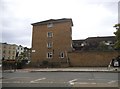
Flats on the corner of York Way and Agar Grove
Image: © David Howard
Taken: 28 Aug 2014
0.11 miles
