
IMAGES TAKEN NEAR TO
Camden Park Road, LONDON, NW1 9AX
Introduction
This page details the photographs taken nearby to Camden Park Road, NW1 9AX by members of the Geograph project.
The Geograph project started in 2005 with the aim of publishing, organising and preserving representative images for every square kilometre of Great Britain, Ireland and the Isle of Man.

There are currently over 7.5m images from over14,400 individuals and you can help contribute to the project by visiting https://www.geograph.org.uk
Image Map
Images are licensed for reuse under creativecommons.org/licenses/by-sa/2.0
Notes
- Clicking on the map will re-center to the selected point.
- The higher the marker number, the further away the image location is from the centre of the postcode.
Image Listing (74 Images Found)
Images are licensed for reuse under creativecommons.org/licenses/by-sa/2.0
Image
Details
Distance
3
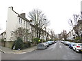
St. Augustine's Road, near Camden Town
St. Augustine's Road is a residential road in the inner suburbs of north London.
Image: © Malc McDonald
Taken: 26 Jan 2019
0.03 miles
5
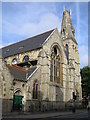
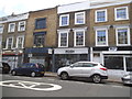
Camden: Disused Presbyterian chapel in Camden Park Road, NW1
There is no evidence on the building to ascertain either the type or the name of this former church, which is on the south side of the junction of Camden Park Road and North Villas. The only indication of its age is that the fabric contains a foundation stone that was laid in 1869. The various spaces inside it are now in use as commercial studios. At some stage the church has lost the top of its steeple, and what remains has been adorned unsympathetically by mobile telephone antennae. The church is a well-known landmark, being on the northbound one-way section of the A5200 from King's Cross at the north end of York Way.
-*-*-
Update of title and description in November 2010 following a request for information from a correspondent:
Old large scale Ordnance Survey maps describe the building thus:
1850: Not shown
1873: Described as "English Presbyterian Chapel"
1895: Described as "Presbyterian Chapel"
1916: Described as "Presbyterian Church"
1954: Described as "Warehouse" although I can't zoom in far enough to be
certain
1970: As 1954
One of the quirks of Victorian Ordnance Survey maps was to list how many people could be seated in an ecclesiastical establishment, in this case 600! The adjoining building to the left is described as a Lecture Room in 1873 and a Lecture Hall in 1895.
Image: © Nigel Cox
Taken: 30 Jul 2006
0.06 miles
6
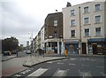
Camden Park Road at the junction of York Road
Image: © David Howard
Taken: 28 Aug 2014
0.06 miles
7
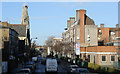
Camden Park Road
Seen from the top deck of a 390 bus.
Image: © Martin Addison
Taken: 13 Jan 2014
0.07 miles
8
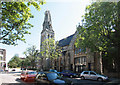
Redundant Presbyterian Church, Camden Park Road
Image: © John Salmon
Taken: 2 May 2011
0.07 miles
9
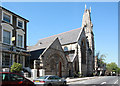
Redundant Presbyterian Church, Camden Park Road
Image: © John Salmon
Taken: 2 May 2011
0.08 miles
10
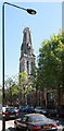
Redundant Presbyterian Church, Camden Park Road
Image: © John Salmon
Taken: 2 May 2011
0.08 miles