
IMAGES TAKEN NEAR TO
Clarence Way, LONDON, NW1 8SG
Introduction
This page details the photographs taken nearby to Clarence Way, NW1 8SG by members of the Geograph project.
The Geograph project started in 2005 with the aim of publishing, organising and preserving representative images for every square kilometre of Great Britain, Ireland and the Isle of Man.

There are currently over 7.5m images from over14,400 individuals and you can help contribute to the project by visiting https://www.geograph.org.uk
Image Map
Images are licensed for reuse under creativecommons.org/licenses/by-sa/2.0
Notes
- Clicking on the map will re-center to the selected point.
- The higher the marker number, the further away the image location is from the centre of the postcode.
Image Listing (671 Images Found)
Images are licensed for reuse under creativecommons.org/licenses/by-sa/2.0
Image
Details
Distance
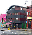
2
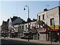
Kentish Town Road, NW1, north of Farrier Street
Image: © Mike Quinn
Taken: 8 Mar 2011
0.03 miles
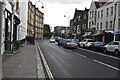
4
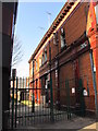
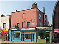
Castle Place, NW1
The building on the right is Image
Image: © Mike Quinn
Taken: 8 Mar 2011
0.04 miles
6
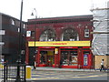
Disused tube station- Kentish Town South
The brown tiles on the front of this building betray its former use as a Northern Line tube station. It is on the west side of Kentish Town Road where St Pancras Way joins. Kentish Town South was open between 1907 and 1924. If you look carefully out of the window of Northern Line trains between Camden Town and Kentish Town you can see the former platform.
See http://www.geograph.org.uk/photo/2255176 http://www.geograph.org.uk/photo/2778778 http://www.geograph.org.uk/photo/3974 for more examples of Northern line tube station built in this style.
See http://www.abandonedstations.org.uk/ an excellent website devoted to London's disused tube stations.
Image: © Bikeboy
Taken: 21 Sep 2013
0.05 miles
8
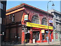
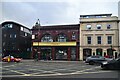
The former South Kentish Town tube station, Kentish Town Road, NW1
The station, between Camden Town and Kentish Town on the Barnet Branch of the Northern Line, was closed in 1924 owing to the low numbers of passengers using it. For further info see the Wiki entry http://en.wikipedia.org/wiki/South_Kentish_Town_tube_station. For photos of the interior, see http://www.abandonedstations.org.uk/South_Kentish_Town_station.html.
Image: © Mike Quinn
Taken: 8 Mar 2011
0.05 miles
9
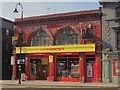
The former South Kentish Town tube station, Kentish Town Road, NW1 (2)
See Image
Image: © Mike Quinn
Taken: 8 Mar 2011
0.05 miles
10
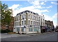
Kentish Town, police office
At the corner of Kentish Town Road and Farrier Street; not, apparently, a police station, but base of the Kentish Town and Cantelowes Wards Safer Neighbourhoods team. http://content.met.police.uk/Team/Camden/KentishTown
Image: © Mike Faherty
Taken: 30 Jun 2012
0.05 miles