
IMAGES TAKEN NEAR TO
Parkway, LONDON, NW1 7PG
Introduction
This page details the photographs taken nearby to Parkway, NW1 7PG by members of the Geograph project.
The Geograph project started in 2005 with the aim of publishing, organising and preserving representative images for every square kilometre of Great Britain, Ireland and the Isle of Man.

There are currently over 7.5m images from over14,400 individuals and you can help contribute to the project by visiting https://www.geograph.org.uk
Image Map
Images are licensed for reuse under creativecommons.org/licenses/by-sa/2.0
Notes
- Clicking on the map will re-center to the selected point.
- The higher the marker number, the further away the image location is from the centre of the postcode.
Image Listing (966 Images Found)
Images are licensed for reuse under creativecommons.org/licenses/by-sa/2.0
Image
Details
Distance
1
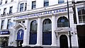
Jazz Cafe, NW1
Situated in Parkway, not only can you listen to jazz here, at weekends, they have discos that specialize in 80's and 90's music.
Image: © Phillip Perry
Taken: 1 Jan 2013
0.01 miles
2
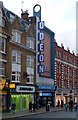
Odeon Cinema, Camden Town
Built 1936 to the designs of architects Daniel MacKay, William Edward Trent, W. Sydney Trent. This and other historical information may be found at this http://cinematreasures.org/theaters/6281. This image Image] is a reminder that the name of the cinema was originally the Gaumont.
Image: © Jim Osley
Taken: 31 Dec 2014
0.01 miles
3
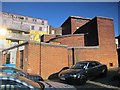
Camden Town deep shelter (south), Stanmore Place, NW1 (3)
In late 1940, the government decided to build a system of deep (air raid) shelters linked to existing underground stations. Each deep shelter consisted of two parallel tubes that might be used for future express underground lines. Seven such shelters were built at Northern Line stations - Belsize Park, Camden Town, Goodge Street, Stockwell, Clapham North, Clapham Common and Clapham South. Each shelter had two entrances with a “pill box” and ventilation shafts; most of these are still there today (February 2011). Some of the deep shelters are in use for secure storage of documents.
This shelter can be seen on the satellite image http://wtp2.appspot.com/wheresthepath.htm?lat=51.538409612490504&lon=-0.14319509267807007&gz=19&oz=10>=1 . [Source: “Beneath the City Streets” by Peter Laurie (1970, revised 1979).]
Image: © Mike Quinn
Taken: 8 Feb 2011
0.01 miles
4
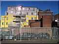
Camden Town deep shelter (south), Stanmore Place, NW1
In late 1940, the government decided to build a system of deep (air raid) shelters linked to existing underground stations. Each deep shelter consisted of two parallel tubes that might be used for future express underground lines. Seven such shelters were built at Northern Line stations - Belsize Park, Camden Town, Goodge Street, Stockwell, Clapham North, Clapham Common and Clapham South. Each shelter had two entrances with a “pill box” and ventilation shafts; most of these are still there today (February 2011). Some of the deep shelters are in use for secure storage of documents.
This shelter can be seen on the satellite image http://wtp2.appspot.com/wheresthepath.htm?lat=51.538409612490504&lon=-0.14319509267807007&gz=19&oz=10>=1 . [Source: “Beneath the City Streets” by Peter Laurie (1970, revised 1979).]
Image: © Mike Quinn
Taken: 8 Feb 2011
0.01 miles
5
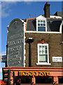
Masala Zone, Camden Town
Nowadays these premises on the corner of Arlington Road and Parkway are occupied by an Indian restaurant, but their former life as a pub is given away by the Truman, Hanbury, Buxton & Co Ltd relief above. In fact, in their last incarnation as a public house, this was the Rat and Parrot which closed in 2005.
Image: © Stephen McKay
Taken: 22 Oct 2008
0.01 miles
6
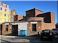
Camden Town deep shelter (south), Stanmore Place, NW1 (2)
In late 1940, the government decided to build a system of deep (air raid) shelters linked to existing underground stations. Each deep shelter consisted of two parallel tubes that might be used for future express underground lines. Seven such shelters were built at Northern Line stations - Belsize Park, Camden Town, Goodge Street, Stockwell, Clapham North, Clapham Common and Clapham South. Each shelter had two entrances with a “pill box” and ventilation shafts; most of these are still there today (February 2011). Some of the deep shelters are in use for secure storage of documents.
This shelter can be seen on the satellite image http://wtp2.appspot.com/wheresthepath.htm?lat=51.538409612490504&lon=-0.14319509267807007&gz=19&oz=10>=1. [Source: “Beneath the City Streets” by Peter Laurie (1970, revised 1979).]
Image: © Mike Quinn
Taken: 8 Feb 2011
0.01 miles
7
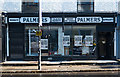
Former pet shop, Parkway, Camden Town
Grade II listed shopfront, described at this https://historicengland.org.uk/listing/the-list/list-entry/1392085.
Image: © Jim Osley
Taken: 16 Oct 2016
0.01 miles

9
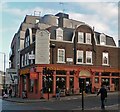
Former "Camden Stores" public house
"By A E Sewell for Trumans. On the corner splay, a large terracotta panel with the date '1924' around a trademark eagle, and raised lettering: 'TRUMAN HANBURY BUXTON & Co. Ltd. - THE CAMDEN STORES'." - quoted from this http://www.breweryhistory.com/Defunct/LondonNorthWest.htm. Sewell was Truman's in-house architect: other public houses designed by him include "The Rose & Crown", Stoke Newington Church Street, N16, "The Royal George", Eversholt Street NW1, "The Royal Oak", Columbia Road E2, "The Royal Oak", Glenthorne Road W6, "The Sir Sidney Smith", Dock Street E1, "The Stag's Head", Oarsman Road N1, "The Ivy House, 40 Stuart Road, Nunhead, London, SE15" (Grade II listed), and many others.
Image: © Jim Osley
Taken: 31 Dec 2014
0.02 miles
10
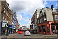
Approaching the Britannia junction and Camden High Street
Image: © Roger Davies
Taken: 14 Aug 2011
0.02 miles