
IMAGES TAKEN NEAR TO
Albert Street, LONDON, NW1 7NR
Introduction
This page details the photographs taken nearby to Albert Street, NW1 7NR by members of the Geograph project.
The Geograph project started in 2005 with the aim of publishing, organising and preserving representative images for every square kilometre of Great Britain, Ireland and the Isle of Man.

There are currently over 7.5m images from over14,400 individuals and you can help contribute to the project by visiting https://www.geograph.org.uk
Image Map
Images are licensed for reuse under creativecommons.org/licenses/by-sa/2.0
Notes
- Clicking on the map will re-center to the selected point.
- The higher the marker number, the further away the image location is from the centre of the postcode.
Image Listing (468 Images Found)
Images are licensed for reuse under creativecommons.org/licenses/by-sa/2.0
Image
Details
Distance
1
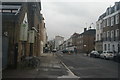
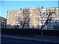
View of flats on Mornington Crescent, Harrington Square and Hampstead Road from Arlington Road
Looking south-southeast.
Image: © Robert Lamb
Taken: 23 Jan 2016
0.04 miles
2
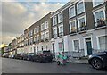
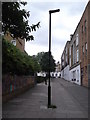
Terrace of houses on Arlington Road, Camden Town
Image: © David Howard
Taken: 20 Oct 2022
0.04 miles
6
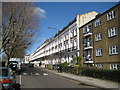
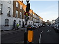
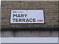
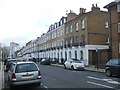
Camden: Mornington Terrace, NW1
As its more famous neighbour, Mornington Crescent, Mornington Terrace was named after the 2nd Earl of Mornington (1760 - 1842), Richard Colley Wellesley. Wellesley was an elder brother of the Duke of Wellington. The fine lines of the terrace are ruined by the totally unsympathetic post-war flat development at the near end, almost certainly the consequence of Second World War bomb damage. The terrace overlooks the main railway out of Euston, over the wall to the far left, which would have been a strategic target during hostilities.
Image: © Nigel Cox
Taken: 8 Mar 2009
0.05 miles
8
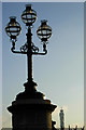
Lamps on Mornington Street
These ornate lamps are fixed to a column on the parapet at the eastern end of Mornington Street Bridge; there is an identical set on the opposite side of the road. They were erected when the road was widened around 1900 and the columns and lamp standards are now listed (although the bridge itself is not). The top of the BT Tower can be seen in the distance.
Image: © Stephen McKay
Taken: 3 Dec 2008
0.06 miles
10
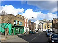
Mornington Street
Just round the corner from the more famous Crescent.
The pub is the Sheephaven Bay which is an unusual name for a pub.
It's an unusual name for a bay too, according to this bit from Wikipedia.
"Sheephaven Bay (Irish: Cuan na gCaorach) is a broad, shallow inlet on the north coast of County Donegal, Ireland. Bounded by the peninsulae of Rosguill, to the east and Horn Head (Irish: Corran Binne) to the west, the bay is relatively protected from the full force of the Atlantic Ocean, and has supported a vibrant herring fleet.
The Gaelic name Cuan na gCaorach (Haven of the Sheep) is a neologism, from a mistranslation of Cuan na gCurrach, The Bay or Haven of the Currachs or Boats. When the name was translated to English, the word Ship (used by monoglot locals for Boat) was misheard as Sheep."
Which only goes to show, it's hard to tell the sheep from the boats.....
Image: © Des Blenkinsopp
Taken: 3 Mar 2015
0.06 miles