
IMAGES TAKEN NEAR TO
Gloucester Avenue, LONDON, NW1 7AT
Introduction
This page details the photographs taken nearby to Gloucester Avenue, NW1 7AT by members of the Geograph project.
The Geograph project started in 2005 with the aim of publishing, organising and preserving representative images for every square kilometre of Great Britain, Ireland and the Isle of Man.

There are currently over 7.5m images from over14,400 individuals and you can help contribute to the project by visiting https://www.geograph.org.uk
Image Map
Images are licensed for reuse under creativecommons.org/licenses/by-sa/2.0
Notes
- Clicking on the map will re-center to the selected point.
- The higher the marker number, the further away the image location is from the centre of the postcode.
Image Listing (508 Images Found)
Images are licensed for reuse under creativecommons.org/licenses/by-sa/2.0
Image
Details
Distance
1
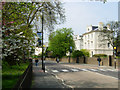
Prince Albert Road, Camden Town
Prince Albert Road skirts the north side of Regent's Park.
Image: © Stephen McKay
Taken: 17 Apr 2007
0.03 miles
3
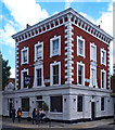
"The Engineer" public house, Gloucester Avenue, NW1
Grade II listed mid-Victorian public house. Architectural description at this https://historicengland.org.uk/listing/the-list/list-entry/1342071. For a possible connection to Isambard Kingdom Brunel see this http://www.shadyoldlady.com/location.php?loc=1071.
Image: © Jim Osley
Taken: 2 Jul 2016
0.03 miles
5
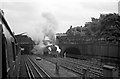
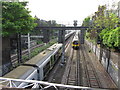
Climbing Camden Bank, 1960
An unidentifiable Jubilee class 4-6-0 locomotive blasts out of Park Street Tunnel on the climb (approx 1 in 100) out of Euston.
Image: © Alan Murray-Rust
Taken: Unknown
0.03 miles
6
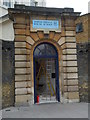
North Bridge House School, 1 Gloucester Avenue NW1
Image: © Robin Sones
Taken: 12 Aug 2013
0.05 miles
7
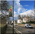
Tiger Territory, Prince Albert Road
The zoo is just down the road.
Image: © Des Blenkinsopp
Taken: 3 Mar 2015
0.05 miles
8
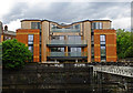
Granby House, Granby Terrace, London NW1
Built in 2014, Granby House is in area to be demolished as it is in the path of the projected HS2 High Speed Rail Project. More on this unusual state of affairs at this http://www.camdennewjournal.com/news/2014/jul/hs2-not-certainty-work-begins-new-housing-block-middle-demolition-zone.
Image: © Jim Osley
Taken: 22 May 2016
0.05 miles
9
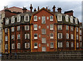
Stalbridge House, 231 Hampstead Road
According to this www.camden.gov.uk/ccm/cms-service/download/asset?asset_id=2982428 Stalbridge House will be demolished as part of the controversial HS2 High Speed Railway project.
Image: © Jim Osley
Taken: 22 May 2016
0.05 miles
10
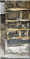
Ordnance Survey 1GL Bolt
This OS Bolt can be found on the post at the junction of Oval Road and Gloucester Crescent. It marks a point 34.636m above mean sea level.
Image: © Adrian Dust
Taken: 18 Aug 2016
0.06 miles