
IMAGES TAKEN NEAR TO
Boston Place, LONDON, NW1 6EX
Introduction
This page details the photographs taken nearby to Boston Place, NW1 6EX by members of the Geograph project.
The Geograph project started in 2005 with the aim of publishing, organising and preserving representative images for every square kilometre of Great Britain, Ireland and the Isle of Man.

There are currently over 7.5m images from over14,400 individuals and you can help contribute to the project by visiting https://www.geograph.org.uk
Image Map
Images are licensed for reuse under creativecommons.org/licenses/by-sa/2.0
Notes
- Clicking on the map will re-center to the selected point.
- The higher the marker number, the further away the image location is from the centre of the postcode.
Image Listing (908 Images Found)
Images are licensed for reuse under creativecommons.org/licenses/by-sa/2.0
Image
Details
Distance
1
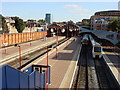
Marylebone Station Platforms
This is Marylebone station as seen from Rossmore Road, On the right can be seen the new platforms 5 and 6 which were opened in May 2006 to cope with increased passenger numbers. In the distance Image can be seen.
Image: © Oxyman
Taken: 4 Sep 2007
0.01 miles

3
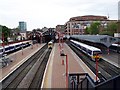
View over platforms, Marylebone Station
This is the view over the high bridge wall in Rossmore Road
Image: © David Martin
Taken: 19 May 2010
0.01 miles
4

Boston Place, NW1
Running south beside Marylebone station.
Image: © Robin Webster
Taken: 28 Jan 2020
0.01 miles
5

Houses, Balcombe Street, NW1
Looking north. The terrace is grade II listed, from 1815-20.
Image: © Robin Webster
Taken: 28 Jan 2020
0.01 miles
6

Marylebone Station
Marylebone is one of London's smaller railway termini, but it nevertheless has a great deal of character. It was originally the terminus of the Great Central Railway which ran trains from Yorkshire and the East Midlands; today trains run from here to the Chilterns and beyond to Birmingham.
Image: © Stephen McKay
Taken: 17 Jan 2007
0.01 miles
7

Benchmark on wall opposite #90 Boston Place
Ordnance Survey cut mark benchmark described on the Bench Mark Database at http://www.bench-marks.org.uk/bm37524
Image: © Roger Templeman
Taken: 8 Apr 2011
0.01 miles

9

Ordnance Survey Cut Mark
This OS cut mark can be found on the west side of Boston Place. It marks a point 31.739m above mean sea level.
Image: © Adrian Dust
Taken: 18 Aug 2016
0.01 miles
10
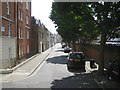
South on Boston Place from the steps off Rossmore Road
Taunton Place, left, runs parallel to the elevated Rossmore Road http://www.geograph.org.uk/p/4104680 On the right is a glimpse of Marylebone station.
Image: © Robin Stott
Taken: 3 Aug 2014
0.02 miles