IMAGES TAKEN NEAR TO
Camden, LONDON, NW1 4XW

Introduction

This page details the photographs taken nearby to NW1 4XW by members of the Geograph project.

The Geograph project started in 2005 with the aim of publishing, organising and preserving representative images for every square kilometre of Great Britain, Ireland and the Isle of Man.

There are currently over 7.5m images from over14,400 individuals and you can help contribute to the project by visiting https://www.geograph.org.uk

Image Map


Images are licensed for reuse under creativecommons.org/licenses/by-sa/2.0
Notes
  • Clicking on the map will re-center to the selected point.
  • The higher the marker number, the further away the image location is from the centre of the postcode.

Image Listing (741 Images Found)

Images are licensed for reuse under creativecommons.org/licenses/by-sa/2.0
  • ...
Image
Details
Distance
1
Royal Mail depot, Eversholt Street London
King's Cross Depot on the corner of Barnby Street and Eversholt Street behind London Euston.
Image: © Rossographer Taken: 17 Feb 2019
0.02 miles
2
Double Elizabeth II postbox on Barnby Street. London NW1
Postboxes Nos. NW1 3 and NW1 100. See Image] for context.
Image: © JThomas Taken: 3 Sep 2016
0.02 miles
3
Elizabeth II postboxes on Barnby Street. London NW1
Double Elizabeth II postbox and business box. See Image] for double postbox. See Image] for business box.
Image: © JThomas Taken: 3 Sep 2016
0.03 miles
4
Elizabeth II business postbox on Barnby Street. London NW1
Postbox No. NW1 83. See Image] for context.
Image: © JThomas Taken: 3 Sep 2016
0.03 miles
5
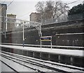
The northern end of the platform, Euston Station
Image: © N Chadwick Taken: 19 Dec 2010
0.03 miles
6
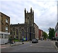
Eversholt Street and St Mary's
Eversholt Street, Somers Town, London Borough of Camden. St Mary's is a Grade II listed church.
Image: © Oxfordian Kissuth Taken: Unknown
0.03 miles
7
Euston Station
A pair of class 501 electric units arrives at Euston from Watford. The tower blocks behind are on the Ampthill Square Estate. Note the hose and the stand pipes in the foreground, used for replenishing the water in carriage toilets.
Image: © Martin Addison Taken: Unknown
0.03 miles
8
Euston Station throat
Image: © Christopher Hilton Taken: 27 Jun 2009
0.04 miles
9
Euston Station
Looking across the northern ends of the platforms from the roadway connecting Cardington Street with the former parcels deck; the blue station signs indicate that this is a Network Rail managed station. Buildings on Eversholt Street can be seen in the background.
Image: © Stephen McKay Taken: 23 Apr 2008
0.04 miles
10
The end of platform 13, Euston Station
Image: © N Chadwick Taken: 4 Apr 2009
0.04 miles
  • ...