
IMAGES TAKEN NEAR TO
Albany Street, LONDON, NW1 4EG
Introduction
This page details the photographs taken nearby to Albany Street, NW1 4EG by members of the Geograph project.
The Geograph project started in 2005 with the aim of publishing, organising and preserving representative images for every square kilometre of Great Britain, Ireland and the Isle of Man.

There are currently over 7.5m images from over14,400 individuals and you can help contribute to the project by visiting https://www.geograph.org.uk
Image Map
Images are licensed for reuse under creativecommons.org/licenses/by-sa/2.0
Notes
- Clicking on the map will re-center to the selected point.
- The higher the marker number, the further away the image location is from the centre of the postcode.
Image Listing (464 Images Found)
Images are licensed for reuse under creativecommons.org/licenses/by-sa/2.0
Image
Details
Distance
1
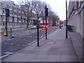
Albany Street looking south
From Chester Gate
Image: © David Howard
Taken: 1 Dec 2009
0.01 miles
2
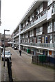
Regent's Park Estate
Behind the blocks on Albany Street.
Image: © Martin Addison
Taken: 30 Dec 2011
0.01 miles
3
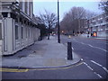
Albany Street looking north
From Chester Gate
Image: © David Howard
Taken: 1 Dec 2009
0.02 miles
4
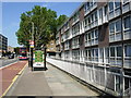
Albany Street, Regent's Park
Looking north towards Camden Town. Part of Camden Council's Regent's Park Estate runs along the eastern side of the street.
Image: © Stephen McKay
Taken: 6 Jun 2006
0.03 miles
5
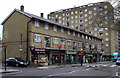
Shops on Robert Street
Providing retail services for residents of the Regent's Park Estate.
Image: © Martin Addison
Taken: 30 Dec 2011
0.05 miles
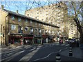
7
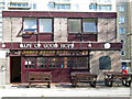
Cape of Good Hope, Regent's Park Estate
Pub on Albany Street with the large Regent's Park Estate forming a backdrop.
Image: © Stephen McKay
Taken: 7 Mar 2008
0.06 miles
8
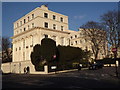
Chester Gate
Spectacular Nash mansions on the eastern edge of Regent's Park.
Image: © Colin Smith
Taken: 3 Feb 2012
0.06 miles
10
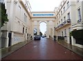
Regent's Park: Chester Terrace
This is the outer elevation of the southern of the two arches at either end of the terrace. Together with the houses and their railings these linking arches form one Grade I Listed Building. The Historic England website describes the arches thus:-
"Linking triumphal arches with round-arched vehicle entrance flanked by pedestrian entrances. Inner elevations with 4 attached Corinthian columns supporting a modillion entablature above which a scrolled frieze, cornice and blocking course. Outer elevations with 4 Corinthian pilasters supporting a modillion entablature with panel inscribed "Chester Terrace", cornice and blocking course."
Image: © Nigel Cox
Taken: 6 Mar 2018
0.06 miles