
IMAGES TAKEN NEAR TO
Redhill Street, LONDON, NW1 4DD
Introduction
This page details the photographs taken nearby to Redhill Street, NW1 4DD by members of the Geograph project.
The Geograph project started in 2005 with the aim of publishing, organising and preserving representative images for every square kilometre of Great Britain, Ireland and the Isle of Man.

There are currently over 7.5m images from over14,400 individuals and you can help contribute to the project by visiting https://www.geograph.org.uk
Image Map
Images are licensed for reuse under creativecommons.org/licenses/by-sa/2.0
Notes
- Clicking on the map will re-center to the selected point.
- The higher the marker number, the further away the image location is from the centre of the postcode.
Image Listing (218 Images Found)
Images are licensed for reuse under creativecommons.org/licenses/by-sa/2.0
Image
Details
Distance
1
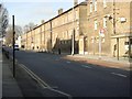
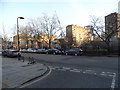
Albany Street Barracks
The Barracks in Albany Street originally housed cavalry which was relocated to St John's Wood Barracks in the latter part of the 20th century.
Image: © Sheila Madhvani
Taken: 27 Jan 2009
0.01 miles
4
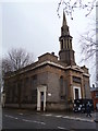
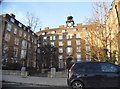
St George's Antiochian Cathedral, Redhill Street NW1
From the junction with Albany Street. The Greek Orthodox Church of Antioch, also known as the Greek Orthodox Patriarchate of Antioch and All the East and the Antiochian Orthodox Church.
Image: © Robin Sones
Taken: 18 Mar 2013
0.04 miles
7
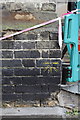
Benchmark on St George's Cathedral, Albany Street
Ordnance Survey 1GL bolt benchmark described on the Bench Mark Database at http://www.bench-marks.org.uk/bm39227
Image: © Roger Templeman
Taken: 20 Aug 2011
0.05 miles
8
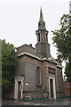
St George's Cathedral, Albany Street
There is an OS benchmark Image to the left of the pavement barriers.
Image: © Roger Templeman
Taken: 20 Aug 2011
0.05 miles
9
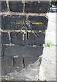
Ordnance Survey 1GL Bolt
This OS Bolt can be found on the south angle of Christ Church. It marks a point 32.849m above mean sea level.
Image: © Adrian Dust
Taken: 18 Aug 2016
0.05 miles
10
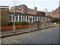
Christchurch Primary School
Primary school in Redhill Street on the Regent's Park Estate.
Image: © Sheila Madhvani
Taken: 16 Feb 2009
0.05 miles