
IMAGES TAKEN NEAR TO
Albany Street, LONDON, NW1 4BF
Introduction
This page details the photographs taken nearby to Albany Street, NW1 4BF by members of the Geograph project.
The Geograph project started in 2005 with the aim of publishing, organising and preserving representative images for every square kilometre of Great Britain, Ireland and the Isle of Man.

There are currently over 7.5m images from over14,400 individuals and you can help contribute to the project by visiting https://www.geograph.org.uk
Image Map
Images are licensed for reuse under creativecommons.org/licenses/by-sa/2.0
Notes
- Clicking on the map will re-center to the selected point.
- The higher the marker number, the further away the image location is from the centre of the postcode.
Image Listing (214 Images Found)
Images are licensed for reuse under creativecommons.org/licenses/by-sa/2.0
Image
Details
Distance
1
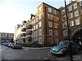
Camberley House on Redhill Street, Regent's Park
Image: © David Howard
Taken: 19 Jan 2017
0.02 miles
2
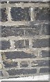
Ordnance Survey Cut Mark
This OS cut mark can be found on No10 Albany Street. It marks a point 34.041m above mean sea level.
Image: © Adrian Dust
Taken: 18 Aug 2016
0.02 miles
3
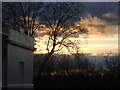
Winter sunset over Regent's Park
A beautiful sky over Cumberland Green, Regent's Park
Image: © Sheila Madhvani
Taken: 13 Feb 2009
0.03 miles
4
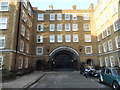
Camberley House on Redhill Street, Regent's Park
Image: © David Howard
Taken: 19 Jan 2017
0.03 miles
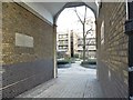
6
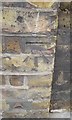
Ordnance Survey Cut Mark
This OS cut mark can be found on the NE side of Albany Street. It marks a point 34.629m above mean sea level.
Image: © Adrian Dust
Taken: 18 Aug 2016
0.05 miles
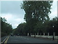
8
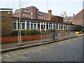
Christchurch Primary School
Primary school in Redhill Street on the Regent's Park Estate.
Image: © Sheila Madhvani
Taken: 16 Feb 2009
0.05 miles
9
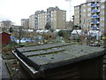
Allotments on the Regent's Park Estate
These allotments are bordered on three sides by blocks of flats and by the Regent's Park Barracks on the fourth side (the north) Managed by Camden Council, they are much sought after with long waiting lists.
Image: © Sheila Madhvani
Taken: 13 Jan 2009
0.05 miles
10
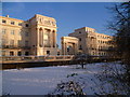
Cumberland Terrace in the snow
Seen from the Outer Circle of Regent's Park, Cumberland Terrace always looks even more impressive with a blue sky behind. Designed by John Nash, Cumberland Terrace was completed in 1826.
Image: © Marathon
Taken: 21 Jan 2013
0.05 miles