IMAGES TAKEN NEAR TO
William Road, LONDON, NW1 3EN
Introduction
This page details the photographs taken nearby to William Road, NW1 3EN by members of the Geograph project.
The Geograph project started in 2005 with the aim of publishing, organising and preserving representative images for every square kilometre of Great Britain, Ireland and the Isle of Man.

There are currently over 7.5m images from over14,400 individuals and you can help contribute to the project by visiting https://www.geograph.org.uk
Image Map
Images are licensed for reuse under creativecommons.org/licenses/by-sa/2.0
Notes
- Clicking on the map will re-center to the selected point.
- The higher the marker number, the further away the image location is from the centre of the postcode.
Image Listing (644 Images Found)
Images are licensed for reuse under creativecommons.org/licenses/by-sa/2.0
Image
Details
Distance
1
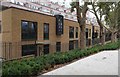
Everton Mews, near Hampstead Road
New local authority housing for the London Borough of Camden.
Image: © Jim Osley
Taken: 19 Sep 2016
0.01 miles
2
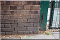
Benchmark on wall at entrance to Netley Primary School and Nursery, William Road
Ordnance Survey cut mark benchmark described on the Bench Mark Database at http://www.bench-marks.org.uk/bm38967
Image: © Roger Templeman
Taken: 20 Aug 2011
0.01 miles
3
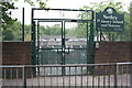
Netley Primary School and Nursery through its William Road entrance
Image: © Roger Templeman
Taken: 20 Aug 2011
0.01 miles
4
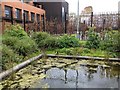
Netley Primary School, Garden pond
Our new garden pond. It has recently attracted mating pairs of mallards.
Image: © P KAVANAGH
Taken: 28 Apr 2016
0.02 miles
5
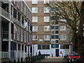
William Road, Regent's Park Estate
Looking towards Munster Square from Stanhope street; the block on the left is Pangbourne.
Image: © Stephen McKay
Taken: 16 Jan 2008
0.03 miles
6
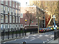
Stanhope Street, Regent's Park
The blocks on the left are part of Camden Council's large Regent's Park Estate.
Image: © Stephen McKay
Taken: 16 Jan 2008
0.03 miles
7
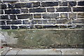
Benchmark on wall of Netley Street
Ordnance Survey cut mark benchmark described on the Bench Mark Database at http://www.bench-marks.org.uk/bm39277
Image: © Roger Templeman
Taken: 20 Aug 2011
0.04 miles
8
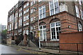
Netley Street School
There is an OS benchmark Image on the wall past the far end of the school
Image: © Roger Templeman
Taken: 20 Aug 2011
0.04 miles
9
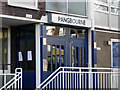
Entrance to Pangbourne
The secure doorway to Pangbourne Block off William Road, part of Camden Council's Regent's Park Estate.
Image: © Stephen McKay
Taken: 16 Jan 2008
0.04 miles