
IMAGES TAKEN NEAR TO
Hampden Close, LONDON, NW1 1HL
Introduction
This page details the photographs taken nearby to Hampden Close, NW1 1HL by members of the Geograph project.
The Geograph project started in 2005 with the aim of publishing, organising and preserving representative images for every square kilometre of Great Britain, Ireland and the Isle of Man.

There are currently over 7.5m images from over14,400 individuals and you can help contribute to the project by visiting https://www.geograph.org.uk
Image Map
Images are licensed for reuse under creativecommons.org/licenses/by-sa/2.0
Notes
- Clicking on the map will re-center to the selected point.
- The higher the marker number, the further away the image location is from the centre of the postcode.
Image Listing (1326 Images Found)
Images are licensed for reuse under creativecommons.org/licenses/by-sa/2.0
Image
Details
Distance
1
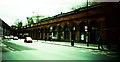
View of a terrace of shops on Pancras Road
Taken using E6 colour slide film, looking south-southeast.
Image: © Robert Lamb
Taken: 2 Apr 2017
0.03 miles
2
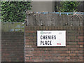
Street nameplate mounted on a brown brick wall
No visible fixings in this frontal view, unlike Image The plate appears to stand proud of the wall. Although all upper-case, the letters are in a widely-spaced condensed font, making them easy to read.
The typeface for the streetname looks for all the world like Franklin Gothic Extra Condensed, designed by Morris Fuller Benton for American Type Founders and issued in 1906. http://en.wikipedia.org/wiki/Franklin_Gothic
The grid reference may not be quite correct but, hey, it's a short street.
Image: © Robin Stott
Taken: 8 Jun 2012
0.03 miles
3
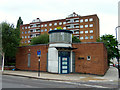
Art deco times two?
On Goldington Street.
Image: © David Lally
Taken: 14 Jun 2014
0.03 miles
4
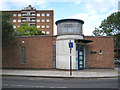
Entrance, Doreen Bazell Hall, NW1
It is a small public hall on the corner of Chenies Place and Goldington Street. It may be hired from Camden Council. It has many different users. In the background here is he block of flats called The Chenies.
Image: © Robin Stott
Taken: 8 Jun 2012
0.03 miles
5
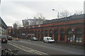
View of St. Pancras Antique Furniture from Pancras Road
Looking south-southeast.
Image: © Robert Lamb
Taken: 23 Jan 2016
0.04 miles
6
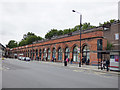
Pancras Road Arches
This 28-bay brick wall, incorporating several small shops in its arches, is a remnant of the Midland Railway's St Pancras coal depot (built 1895-1898). It was listed grade 2 in 1996 as "a rare survival of commercial premises incorporated within a rail goods yard" (list entry 1113245).
Image: © Stephen Craven
Taken: 7 Sep 2017
0.04 miles
7
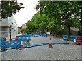
Purchese Street
Temporarily closed for road works.
Image: © Stephen Craven
Taken: 28 Jun 2022
0.04 miles
9
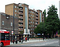
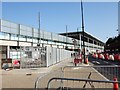
The Chenies
Art Deco touches on this apartment block in the Goldington Street Estate on Pancras Road.
Image: © Thomas Nugent
Taken: 10 Sep 2012
0.04 miles
10
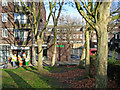
Cooper's Lane Estate, Somers Town
Local authority housing to the north of the British Library, seen from Purchese Street.
Image: © Stephen McKay
Taken: 10 Jan 2007
0.05 miles