
IMAGES TAKEN NEAR TO
Mitchellbrook Way, LONDON, NW10 8PF
Introduction
This page details the photographs taken nearby to Mitchellbrook Way, NW10 8PF by members of the Geograph project.
The Geograph project started in 2005 with the aim of publishing, organising and preserving representative images for every square kilometre of Great Britain, Ireland and the Isle of Man.

There are currently over 7.5m images from over14,400 individuals and you can help contribute to the project by visiting https://www.geograph.org.uk
Image Map
Images are licensed for reuse under creativecommons.org/licenses/by-sa/2.0
Notes
- Clicking on the map will re-center to the selected point.
- The higher the marker number, the further away the image location is from the centre of the postcode.
Image Listing (133 Images Found)
Images are licensed for reuse under creativecommons.org/licenses/by-sa/2.0
Image
Details
Distance
1
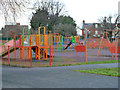
Play apparatus, Gibbons Recreation Ground
By the path out to Bridge Road.
Image: © Robin Webster
Taken: 12 Feb 2011
0.05 miles


5
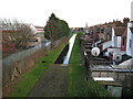
Grand Union Canal feeder channel in Wembley
The Grand Union Canal between Brentford and Uxbridge was completed in 1794, and as traffic grew, there was an increasing demand for water to replenish it as locks were emptied. To solve the problem this feeder channel was built around 1811 from the River Brent, near where the Brent Reservoir is now, to the main canal in Park Royal at Waxlow Road. The feeder was gravity fed and for the most part followed the natural contours. The Brent Reservoir was subsequently built in 1835 and the feeder was then supplied through a tunnel in the dam. So this feature predates all the roads, railways and buildings that we are familiar with today, and a look at the Ordnance Survey map of 1873 shows it flowing in open fields with the River Brent to the west and the separate villages of Neasden and Willesden to the east. The Feeder is no longer the major source of water for the canal, that role being fulfilled by the River Colne and Fray's River.
This view was taken from a footbridge over the North Circular Road looking along the back of the houses in Woodheyes Road.
Image: © Nigel Cox
Taken: 9 Mar 2008
0.09 miles
6
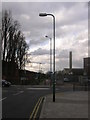
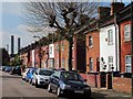
Neasden Footpath and Cyclepath from Meadow Gate, NW10
Looking across Brentfield Road, NW10 - the Swaminarayan School building can be seen on the right and one of the chimneys from Taylor's Lane Power Station.
Image: © Robin Sones
Taken: 27 Mar 2009
0.10 miles
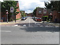
9
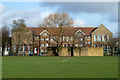
Mitchell Brook Primary School
Looking across Gibbons Recreation Ground at the main and older block.
Image: © Robin Webster
Taken: 12 Feb 2011
0.10 miles
10
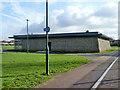
Pavilion, Gibbons Recreation Ground
An unusual construction featuring what look like stacked cages of stone, similar to those used to stabilize slipping railway cuttings and the like.
Image: © Robin Webster
Taken: 12 Feb 2011
0.12 miles