
IMAGES TAKEN NEAR TO
Gorst Road, LONDON, NW10 6LA
Introduction
This page details the photographs taken nearby to Gorst Road, NW10 6LA by members of the Geograph project.
The Geograph project started in 2005 with the aim of publishing, organising and preserving representative images for every square kilometre of Great Britain, Ireland and the Isle of Man.

There are currently over 7.5m images from over14,400 individuals and you can help contribute to the project by visiting https://www.geograph.org.uk
Image Map
Images are licensed for reuse under creativecommons.org/licenses/by-sa/2.0
Notes
- Clicking on the map will re-center to the selected point.
- The higher the marker number, the further away the image location is from the centre of the postcode.
Image Listing (63 Images Found)
Images are licensed for reuse under creativecommons.org/licenses/by-sa/2.0
Image
Details
Distance
1
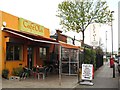
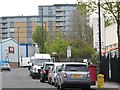
Caf? Ola, Chase Road, NW10
Shows the location of Image
Image: © Mike Quinn
Taken: 20 Apr 2012
0.09 miles
2
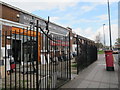
Marble Arch Bathrooms, Kitchens and Tiles, Chase Road, NW10
Shows the location of Image
Image: © Mike Quinn
Taken: 20 Apr 2012
0.09 miles
3
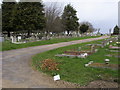
Acton Cemetery
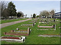
Acton Cemetery this area is just North of the Central Line at North Acton
Image: © Shaun Ferguson
Taken: 27 Mar 2009
0.09 miles
4
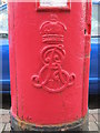
Edward VII postbox, Chase Road / Gorst Road, NW10 - royal cipher
See Image
Image: © Mike Quinn
Taken: 20 Apr 2012
0.09 miles
5
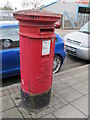
Edward VII postbox, Chase Road / Gorst Road, NW10
Image: © Mike Quinn
Taken: 20 Apr 2012
0.09 miles
8
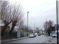
Chase Road, North Acton
Chase Road in North Acton, North West London.
Image: © Malc McDonald
Taken: 28 Dec 2012
0.12 miles
9
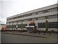
TNT offices on Bashley Road
TNT is an Australian delivery company and stands for Thomas Nationwide Transport and began with one lorry in 1946 http://www.tnt.com/corporate/en/site/home/about_us/history.html
Image: © David Howard
Taken: 13 Jun 2015
0.14 miles
10
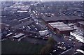
Park Royal Estate from Acton Lane Power Station
The photo was taken from the chimney when it was being decommissioned. The view is along Chase Road. Acton cemetery is on the right of the road near the top of the photo. The Y-junction with a prominent white building has Bashley Road going off to the left. Scan from Kodachrome 35mm colour transparency.
Image: © David Hawgood
Taken: Unknown
0.14 miles