IMAGES TAKEN NEAR TO
Minerva Road, LONDON, NW10 6HH
Introduction
This page details the photographs taken nearby to Minerva Road, NW10 6HH by members of the Geograph project.
The Geograph project started in 2005 with the aim of publishing, organising and preserving representative images for every square kilometre of Great Britain, Ireland and the Isle of Man.

There are currently over 7.5m images from over14,400 individuals and you can help contribute to the project by visiting https://www.geograph.org.uk
Image Map
Images are licensed for reuse under creativecommons.org/licenses/by-sa/2.0
Notes
- Clicking on the map will re-center to the selected point.
- The higher the marker number, the further away the image location is from the centre of the postcode.
Image Listing (34 Images Found)
Images are licensed for reuse under creativecommons.org/licenses/by-sa/2.0
Image
Details
Distance
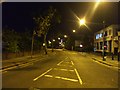
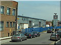
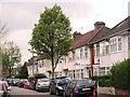
1
Minerva Road, NW10
Part of the Park Royal Industrial Estate.
Image: © Phillip Perry
Taken: 1 Oct 2008
0.04 miles
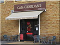
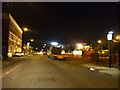
5
New shisha bar on Chase Road
These are popping up all over London and this was previously part of the office car park till 2013, but has a café behind it presumably allowed to extend onto its own front yard.
Image: © David Howard
Taken: 24 Dec 2013
0.15 miles
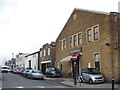
6
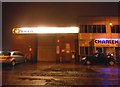
Charlex Garage on Chase Road, Park Royal
Image: © David Howard
Taken: 24 Dec 2013
0.15 miles
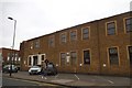
9
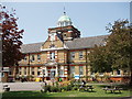
Central Middlesex Hospital, Clock Tower entrance
Image: © David Hawgood
Taken: 7 Jun 2005
0.17 miles