IMAGES TAKEN NEAR TO
Warfield Road, LONDON, NW10 5LA
Introduction
This page details the photographs taken nearby to Warfield Road, NW10 5LA by members of the Geograph project.
The Geograph project started in 2005 with the aim of publishing, organising and preserving representative images for every square kilometre of Great Britain, Ireland and the Isle of Man.

There are currently over 7.5m images from over14,400 individuals and you can help contribute to the project by visiting https://www.geograph.org.uk
Image Map (Loading...)


Getting Data...Please wait
Leaflet Map data © OpenStreetMap
Images are licensed for reuse under creativecommons.org/licenses/by-sa/2.0
Notes
- Clicking on the map will re-center to the selected point.
- The higher the marker number, the further away the image location is from the centre of the postcode.
Image Listing (279 Images Found)
Images are licensed for reuse under creativecommons.org/licenses/by-sa/2.0
Image
Details
Distance
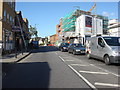
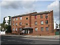
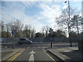
3
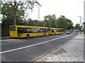
School buses on the Harrow Road
Parked by Kensal Green cemetery.
Image: © Mr Ignavy
Taken: 30 Sep 2010
0.04 miles
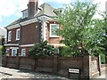
4
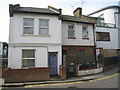
Small town houses
Wellington Road, just off Kilburn Lane.
Image: © Mr Ignavy
Taken: 30 Sep 2010
0.05 miles
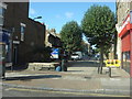
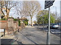
5
Berens Road
Residential road leading Harrow Road.
Image: © Mr Ignavy
Taken: 30 Sep 2010
0.05 miles
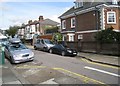
7
Berens Road and The Georgian House
The Georgian House fronts Harrow Road
Image: © David Smith
Taken: 21 May 2011
0.06 miles
9
Berens Road at the junction of Harrow Road
Image: © David Howard
Taken: 12 Apr 2014
0.06 miles
10
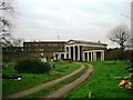
The Dissenter's Chapel, Kensal Green cemetery
The Dissenter's Chapel inside Kensal Green cemetery, over the wall at the back the road with the streetlights is Ladbroke Grove.
Image: © Phillip Perry
Taken: 30 Jan 2007
0.06 miles