IMAGES TAKEN NEAR TO
Buchanan Gardens, LONDON, NW10 5AD
Introduction
This page details the photographs taken nearby to Buchanan Gardens, NW10 5AD by members of the Geograph project.
The Geograph project started in 2005 with the aim of publishing, organising and preserving representative images for every square kilometre of Great Britain, Ireland and the Isle of Man.

There are currently over 7.5m images from over14,400 individuals and you can help contribute to the project by visiting https://www.geograph.org.uk
Image Map
Images are licensed for reuse under creativecommons.org/licenses/by-sa/2.0
Notes
- Clicking on the map will re-center to the selected point.
- The higher the marker number, the further away the image location is from the centre of the postcode.
Image Listing (101 Images Found)
Images are licensed for reuse under creativecommons.org/licenses/by-sa/2.0
Image
Details
Distance
3
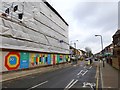
Construction site, Bathurst Gardens
The building will replace the Kensal Rise library Image with a new building with apartments and a new library, after a vigorous campaign to save the facility. Campaigners have decorated the ground level hoardings with stylised bookworms and literary quotations
Image: © David Smith
Taken: 26 Nov 2015
0.06 miles
4
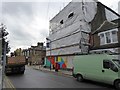
Construction site, corner of Bathurst Gardens/College Road
Site of a new library building for Kensal Rise to replace the old one Image after a vigorous local campaign to maintain library facilities.
Image: © David Smith
Taken: 26 Nov 2015
0.06 miles
7
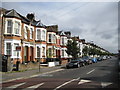
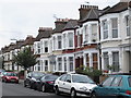
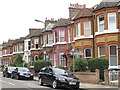
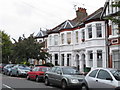
Kensal Green: Buchanan Gardens, NW10
A comparison of the old Ordnance Survey maps of this area shows that in 1896 this area was the Kensal Green Allotments with no housing development north of the railway. By 1915 these houses had been built, and most of those on the surrounding housing estate roads, had been too.
A little further afield, to the east of where College Road is now, the old maps show the "National Athletics Grounds" complete with an oval running track and a pavilion. This feature is still shown on the 1920 map but has been lost by 1935 with the current day houses in Liddell, Whitmore and Leigh Gardens having been built over the site.
Image: © Nigel Cox
Taken: 26 Sep 2010
0.06 miles
9
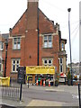
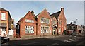
Kensal Rise Library
A campaign is underway to ensure the future of this library
Image: © Andrew Wilson
Taken: 20 Jun 2013
0.06 miles