
IMAGES TAKEN NEAR TO
High Street, LONDON, NW10 4TL
Introduction
This page details the photographs taken nearby to High Street, NW10 4TL by members of the Geograph project.
The Geograph project started in 2005 with the aim of publishing, organising and preserving representative images for every square kilometre of Great Britain, Ireland and the Isle of Man.

There are currently over 7.5m images from over14,400 individuals and you can help contribute to the project by visiting https://www.geograph.org.uk
Image Map
Images are licensed for reuse under creativecommons.org/licenses/by-sa/2.0
Notes
- Clicking on the map will re-center to the selected point.
- The higher the marker number, the further away the image location is from the centre of the postcode.
Image Listing (296 Images Found)
Images are licensed for reuse under creativecommons.org/licenses/by-sa/2.0
Image
Details
Distance
2
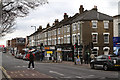
High Street Harlesden
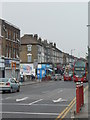
Viewed from outside the local job centre. The road on the right is Nightingale Road.
Image: © Martin Addison
Taken: 15 Feb 2012
0.06 miles
3
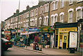
Shops on Harlesden High Street, 2001
Notice the funny name on two of the shops, the main reason I took it, especially as it didn't last long after I did. Apart from the Laundrette none of the shops are still here in 2013.
Image: © David Howard
Taken: Unknown
0.07 miles
4
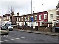
Terraced houses, High Street, Harlesden
A terrace set back from the road, with front gardens which have become space for cars. There is a faded ghost advert on the wall at the left, above "neto"
Image: © David Smith
Taken: 26 Nov 2015
0.08 miles
6
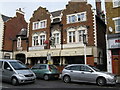
The 'Green Man', Harlesden High Street.
Large and obviously well-kept pub in this busy High Street where the sheer volume of traffic makes photography difficult.
Image: © Dr Neil Clifton
Taken: 12 Feb 2009
0.09 miles
8
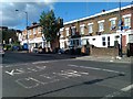
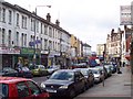
High Street Harlesden
At the junction with Tubbs Road.
Image: © David Martin
Taken: 18 Sep 2012
0.09 miles
9
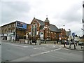
Harlesden, Church of God of Prophecy
Evangelical church on High Street.
Image: © Mike Faherty
Taken: 16 Apr 2016
0.09 miles
10
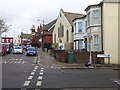
Tubbs Road/Clifton Road junction, Harlesden
Looking towards the Church of God of Prophecy; the cream building was the first Methodist chapel, followed by the red-brick structure beyond. Both were construction sites at the time of the photo
Image: © David Smith
Taken: 26 Nov 2015
0.10 miles